Area Overview for B71 2RD
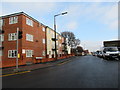
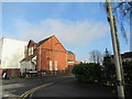
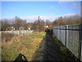
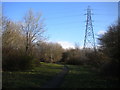
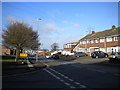
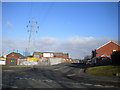
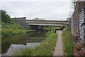
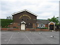
Photos of B71 2RD
Area Information
B71 2RD lies within Hateley Heath, a residential ward in West Bromwich, Sandwell. This small postcode area, home to 2,171 residents, reflects a blend of post-war housing developments and recent community-driven improvements. Originally shaped by 1930s private builders and 1950s council housing, the area faced challenges in the late 20th century, including high unemployment and crime. However, recent initiatives have focused on safety, green spaces, and reducing anti-social behaviour. The population skews towards adults aged 30–64, with a median age of 47, suggesting a community rooted in stability and family life. Living here means navigating a compact urban environment with a mix of local amenities, schools, and transport links. While the area’s history includes social challenges, its proximity to rail networks, retail hubs, and primary schools makes it a practical choice for those prioritising accessibility over grandeur.
- Area Type
- Postcode
- Area Size
- Not available
- Population
- 2171
- Population Density
- 3974 people/km²
B71 2RD’s property market is characterised by a 48% home ownership rate, with the majority of housing stock comprising houses. This suggests a mix of owner-occupied properties and rental units, though the exact proportion of the latter is not specified. The prevalence of houses, rather than flats or apartments, points to a traditional suburban layout, likely featuring semi-detached or terraced homes. As a small postcode area, the housing stock is limited, which may influence property prices and availability. Buyers should consider the local market’s dynamics, noting that the area’s history of council housing and recent refurbishments may offer both value and potential for long-term investment. However, the compact nature of the area means competition for properties could be keen, particularly for families seeking proximity to schools and transport links.
House Prices in B71 2RD
No properties found in this postcode.
Energy Efficiency in B71 2RD
Daily life in B71 2RD revolves around its practical amenities and community-focused environment. Residents can access retail hubs like Co-op Hill, Aldi Tildasley, and Lidl West for groceries and essentials. The area’s rail and metro stations, including Tame Bridge Parkway and Sandwell & Dudley, provide easy access to nearby towns and cities. While parks and green spaces are not explicitly mentioned in the data, the area’s history of community projects suggests efforts to enhance local environments. The presence of multiple primary schools and nearby leisure facilities, such as the Bescot Stadium, adds to the area’s appeal. Though urban, the compact layout ensures that essential services are within reach, supporting a lifestyle that balances convenience with the need for community engagement.
Amenities
Schools
Residents of B71 2RD have access to several primary schools within walking distance, including Hateley Heath Infant School, Hateley Heath Junior School, Kent Close Junior and Infant School, St John Bosco Catholic Primary School, and Menzies High School Science College. These institutions cater to younger children, with a focus on primary education. The presence of multiple schools offers families options, though the data does not include Ofsted ratings or academic performance metrics. The mix of state and Catholic schools reflects the area’s diverse educational landscape. For parents, the proximity of these schools is a significant advantage, reducing the need for long commutes. However, the absence of secondary schools nearby may necessitate travel for older students, a factor to consider when evaluating the area’s suitability for growing families.
| Rank | School | Type | Entry gender | Ages |
|---|
Explore more schools in this area
Go to Schools tabDemographics
The population of B71 2RD is predominantly adults aged 30–64, with a median age of 47. Home ownership sits at 48%, meaning nearly half of residents rent their homes. The accommodation type is largely houses, reflecting a mix of semi-detached and terraced properties. The predominant ethnic group is White, though specific diversity statistics are not provided. This demographic profile suggests a community of middle-aged individuals and families, many of whom may have lived in the area for decades. The 48% home ownership rate indicates a rental market that accommodates both long-term tenants and those seeking investment opportunities. The age range implies a balance between working-age adults and those nearing retirement, shaping local services and amenities to meet the needs of a settled population.
Household Size
Accommodation Type
Tenure
Ethnic Group
Religion
Household Composition
Age
Household Deprivation
NS-SEC
Explore more demographic insights in this area
Go to Demographics tabPlanning
Planning Constraints
- Flood RiskPremium
- Ramsar Wetland SitesPremium
- Area of Outstanding Natural BeautyPremium
- Protected Nature ReservePremium
- Protected WoodlandPremium