Area Overview for B71 2ER
Photos of B71 2ER

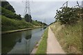
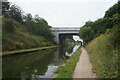
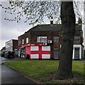
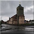
17 photos from this area
Area Information
Key information about the B71 2ER including its size, population, and administrative classification.
- Area Type
- Postcode
- Area Size
- 3169 m²
- Population
- 1622
- Population Density
- 4505 people/km²
House Prices in B71 2ER
13
Properties
£93,345
Average Sold Price
£39,500
Lowest Price
£190,500
Highest Price
Showing 13 properties
| Address | Type | Beds | Baths | Last Sale Price | Last Sale Date | |
|---|---|---|---|---|---|---|
| 28 Moorlands Road, West Bromwich, B71 2ER | Terraced | 2 | 1 | £190,500 | Dec 2023 | |
| 37 Moorlands Road, West Bromwich, B71 2ER | Terraced | 3 | 1 | £118,000 | Feb 2018 | |
| 39 Moorlands Road, West Bromwich, B71 2ER | house | - | - | £128,000 | Mar 2016 | |
| 20 Moorlands Road, West Bromwich, B71 2ER | Terraced | 3 | 2 | £82,500 | Jun 2015 | |
| 41 Moorlands Road, West Bromwich, B71 2ER | house | 3 | - | £76,000 | Jul 2013 | |
| 29 Moorlands Road, West Bromwich, B71 2ER | house | - | - | £98,000 | Jun 2005 | |
| 26 Moorlands Road, West Bromwich, B71 2ER | house | - | - | £86,000 | Jan 2004 | |
| 24 Moorlands Road, West Bromwich, B71 2ER | Terraced | - | - | £65,000 | Jan 2003 | |
| 35 Moorlands Road, West Bromwich, B71 2ER | Terraced | - | - | £49,950 | Nov 1998 | |
| 33 Moorlands Road, West Bromwich, B71 2ER | Terraced | - | - | £39,500 | May 1995 |
Page 1 of 2
Energy Efficiency in B71 2ER
Amenities
Schools
| Rank | School | Type | Entry gender | Ages |
|---|
Explore more schools in this area
Go to Schools tabDemographics
Household Size
Family (3-5 people)
most common
Accommodation Type
Houses
most common
Tenure
63
majority
Ethnic Group
White
most common
Religion
N/A
most common
Household Composition
N/A
most common
Age
47
median
Adults (30-64 years)
most common
Household Deprivation
N/A
with no deprivation
NS-SEC
19
in Lower managerial occupations
Explore more demographic insights in this area
Go to Demographics tabPlanning
Planning Constraints
- Flood RiskPremium
- Ramsar Wetland SitesPremium
- Area of Outstanding Natural BeautyPremium
- Protected Nature ReservePremium
- Protected WoodlandPremium