Area Overview for B71 1WU
Photos of B71 1WU


Area Information
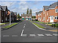
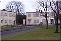
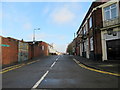
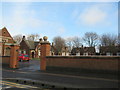
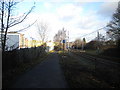
Living in B71 1WU means being part of a small, tightly knit residential cluster in the heart of West Bromwich, a town with deep industrial roots. The area’s population of 2,234 residents reflects its compact nature, with homes concentrated around key local routes like Birmingham Road and Carters Green. West Bromwich itself is a town defined by its proximity to Birmingham, lying just 8 miles west of the city centre. The area benefits from historical infrastructure, including the A41 road, which links it to major regional hubs. Nearby, the West Bromwich Albion Football Club adds a layer of local identity, while Sandwell District General Hospital provides essential healthcare. Daily life here is shaped by a mix of practical amenities—retail outlets, rail stations, and community hubs—positioned to serve both residents and commuters. The area’s small size means a strong sense of familiarity, though its connection to broader networks ensures access to urban opportunities. For those seeking a balance between suburban calm and urban connectivity, B71 1WU offers a distinct slice of West Midlands living.
- Area Type
- Postcode
- Area Size
- Not available
- Population
- Not available
- Population Density
- Not available
The property market in B71 1WU is characterised by a 35% home ownership rate, meaning most properties are rented rather than owned. This suggests a rental-dominated market, which could be influenced by the area’s proximity to employment hubs in Birmingham and the West Midlands. The accommodation type is predominantly houses, which contrasts with the high-density housing typical of larger urban centres. This mix of single-family homes may appeal to those seeking space and privacy, though the small size of the postcode area means the housing stock is limited. Buyers should consider that the market may have fewer options compared to larger towns, with properties likely to be older or mid-century in design. The rental focus could also mean competition for available homes, particularly for those seeking long-term stability. For those prioritising ownership, the area’s compact nature may require looking beyond immediate surroundings for more extensive choices.
House Prices in B71 1WU
No properties found in this postcode.
Energy Efficiency in B71 1WU
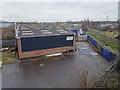
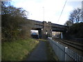
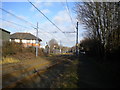
Residents of B71 1WU have access to a range of practical amenities within walking or short driving distance. The area is served by five retail outlets, including Aldi Tildasley and Lidl West, offering everyday shopping needs. Nearby, Co-op Hill provides additional grocery and convenience options. For transport, five rail stations and metro stops like Black Lake and Dudley Street Guns Village ensure easy access to public transit. The presence of Sandwell District General Hospital and local healthcare facilities adds to the area’s appeal. While the data does not specify parks or leisure venues, the proximity to West Bromwich’s town centre—home to the West Bromwich Albion Football Club—suggests opportunities for cultural and social activities. The mix of retail, transport, and healthcare infrastructure creates a functional, community-oriented environment, ideal for those prioritising convenience over sprawling urban amenities.
Amenities
Schools
| Rank | A + A* % | School | Type | Entry gender | Ages |
|---|
Explore more schools in this area
Go to Schools tabDemographics
The community in B71 1WU is predominantly composed of adults aged 30–64, with a median age of 47. This suggests a population skewed towards established professionals and families, rather than younger or older demographics. Home ownership here is relatively low at 35%, indicating that a majority of residents rent their homes. The accommodation type is primarily houses, which is notable in an area where flats or apartments are more common in larger cities. The predominant ethnic group is White, reflecting broader trends in the Sandwell borough. While no specific deprivation data is provided, the low home ownership rate may imply a reliance on rental markets, which could influence the area’s economic dynamics. The age profile suggests a stable, working-age population, though the absence of younger households might affect local schools and community services.
Household Size
Accommodation Type
Tenure
Ethnic Group
Religion
Household Composition
Age
Household Deprivation
NS-SEC
Explore more demographic insights in this area
Go to Demographics tabPlanning
Planning Constraints
- Flood RiskLocked
- Ramsar Wetland SitesLocked
- Area of Outstanding Natural BeautyLocked
- Protected Nature ReserveLocked
- Protected WoodlandLocked
- Crime RiskLocked