Area Overview for B71 1RU
Photos of B71 1RU
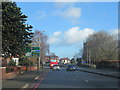
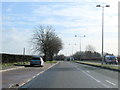
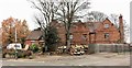
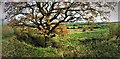
22 photos from this area
Area Information
Key information about the B71 1RU including its size, population, and administrative classification.
- Area Type
- Postcode
- Area Size
- 2.9 hectares
- Population
- 1812
- Population Density
- 5197 people/km²
House Prices in B71 1RU
17
Properties
£404,692
Average Sold Price
£149,500
Lowest Price
£796,576
Highest Price
Showing 17 properties
| Address | Type | Beds | Baths | Last Sale Price | Last Sale Date | |
|---|---|---|---|---|---|---|
| 109 All Saints Way, West Bromwich, B71 1RU | Detached | 3 | - | £796,576 | Sep 2018 | |
| 117 All Saints Way, West Bromwich, B71 1RU | Detached | 3 | 1 | £268,000 | Mar 2016 | |
| 97 All Saints Way, West Bromwich, B71 1RU | Detached | - | - | £149,500 | Mar 2001 | |
| Flat, 97 All Saints Way, West Bromwich, B71 1RU | Flat | - | - | - | - | |
| David Michael Academy Limited, 107 All Saints Way, West Bromwich, B71 1RU | hospital_care_home | - | - | - | - | |
| Sandwell Mbc, Sports Pavilion, Newton Road, West Bromwich, B71 1RU | Leisure | - | - | - | - | |
| 107B All Saints Way, West Bromwich, B71 1RU | Flat | - | - | - | - | |
| 107C All Saints Way, West Bromwich, B71 1RU | Flat | - | - | - | - | |
| 111 All Saints Way, West Bromwich, B71 1RU | hospital_care_home | - | - | - | - | |
| 111A All Saints Way, West Bromwich, B71 1RU | Flat | - | - | - | - |
Page 1 of 2
Energy Efficiency in B71 1RU
Amenities
Schools
| Rank | School | Type | Entry gender | Ages |
|---|
Explore more schools in this area
Go to Schools tabDemographics
Household Size
Family (3-5 people)
most common
Accommodation Type
Houses
most common
Tenure
76
majority
Ethnic Group
White
most common
Religion
N/A
most common
Household Composition
N/A
most common
Age
47
median
Adults (30-64 years)
most common
Household Deprivation
N/A
with no deprivation
NS-SEC
25
in Lower managerial occupations
Explore more demographic insights in this area
Go to Demographics tabPlanning
Planning Constraints
- Flood RiskPremium
- Ramsar Wetland SitesPremium
- Area of Outstanding Natural BeautyPremium
- Protected Nature ReservePremium
- Protected WoodlandPremium