Area Overview for B71 1QW
Photos of B71 1QW
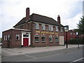
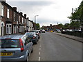
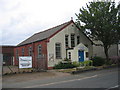
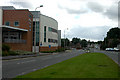

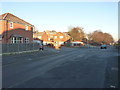
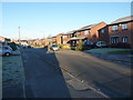
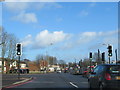
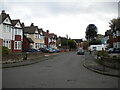
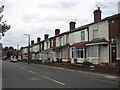
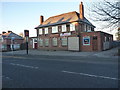
17 photos from this area
Area Information
Key information about the B71 1QW including its size, population, and administrative classification.
- Area Type
- Postcode
- Area Size
- 7687 m²
- Population
- 2393
- Population Density
- 1478 people/km²
House Prices in B71 1QW
22
Properties
£146,041
Average Sold Price
£37,501
Lowest Price
£251,000
Highest Price
Showing 22 properties
| Address | Type | Beds | Baths | Last Sale Price | Last Sale Date | |
|---|---|---|---|---|---|---|
| 45 Wilford Road, West Bromwich, B71 1QW | Semi-detached | 3 | 2 | £250,000 | May 2023 | |
| 49 Wilford Road, West Bromwich, B71 1QW | Retail | 3 | 1 | £251,000 | Oct 2022 | |
| 41 Wilford Road, West Bromwich, B71 1QW | house | 3 | - | £173,000 | Jan 2022 | |
| 61 Wilford Road, West Bromwich, B71 1QW | Semi-detached | 3 | - | £180,000 | Oct 2021 | |
| 25 Wilford Road, West Bromwich, B71 1QW | house | - | - | £160,000 | Dec 2020 | |
| 57 Wilford Road, West Bromwich, B71 1QW | Semi-detached | 3 | 1 | £178,000 | Jul 2020 | |
| 27 Wilford Road, West Bromwich, B71 1QW | Semi-detached | 3 | - | £145,000 | Oct 2016 | |
| 39 Wilford Road, West Bromwich, B71 1QW | Terraced | - | - | £105,000 | Oct 2013 | |
| 31 Wilford Road, West Bromwich, B71 1QW | house | - | - | £68,000 | Jan 2003 | |
| 21 Wilford Road, West Bromwich, B71 1QW | house | - | - | £58,950 | Mar 2002 |
Page 1 of 3
Energy Efficiency in B71 1QW
Amenities
Schools
| Rank | School | Type | Entry gender | Ages |
|---|
Explore more schools in this area
Go to Schools tabDemographics
Household Size
Family (3-5 people)
most common
Accommodation Type
Houses
most common
Tenure
65
majority
Ethnic Group
White
most common
Religion
N/A
most common
Household Composition
N/A
most common
Age
47
median
Adults (30-64 years)
most common
Household Deprivation
N/A
with no deprivation
NS-SEC
26
in Lower managerial occupations
Explore more demographic insights in this area
Go to Demographics tabPlanning
Planning Constraints
- Flood RiskPremium
- Ramsar Wetland SitesPremium
- Area of Outstanding Natural BeautyPremium
- Protected Nature ReservePremium
- Protected WoodlandPremium