Area Overview for B71 1HQ
Photos of B71 1HQ

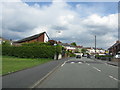


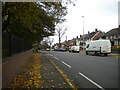
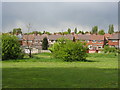

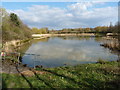

16 photos from this area
Area Information
Key information about the B71 1HQ including its size, population, and administrative classification.
- Area Type
- Postcode
- Area Size
- 8862 m²
- Population
- 1801
- Population Density
- 5656 people/km²
House Prices in B71 1HQ
26
Properties
£104,984
Average Sold Price
£48,000
Lowest Price
£160,000
Highest Price
Showing 26 properties
| Address | Type | Beds | Baths | Last Sale Price | Last Sale Date | |
|---|---|---|---|---|---|---|
| 29 Westmorland Road, West Bromwich, B71 1HQ | house | 2 | 1 | £160,000 | Mar 2025 | |
| 18 Westmorland Road, West Bromwich, B71 1HQ | house | 3 | 1 | £95,000 | Mar 2022 | |
| 26 Westmorland Road, West Bromwich, B71 1HQ | Semi-detached | 3 | 1 | £116,000 | Jan 2019 | |
| 20 Westmorland Road, West Bromwich, B71 1HQ | house | - | - | £106,500 | Apr 2016 | |
| 37A Westmorland Road, West Bromwich, B71 1HQ | Semi-detached | 3 | - | £130,000 | Aug 2015 | |
| 35 Westmorland Road, West Bromwich, B71 1HQ | Semi-detached | 3 | 1 | £127,000 | May 2015 | |
| 29A Westmorland Road, West Bromwich, B71 1HQ | house | - | - | £115,000 | Oct 2011 | |
| 31A Westmorland Road, West Bromwich, B71 1HQ | Terraced | - | - | £98,000 | Jun 2006 | |
| 27 Westmorland Road, West Bromwich, B71 1HQ | house | - | - | £111,000 | Sep 2005 | |
| 16 Westmorland Road, West Bromwich, B71 1HQ | Semi-detached | - | - | £98,000 | Sep 2005 |
Page 1 of 3
Energy Efficiency in B71 1HQ
Amenities
Schools
| Rank | School | Type | Entry gender | Ages |
|---|
Explore more schools in this area
Go to Schools tabDemographics
Household Size
Family (3-5 people)
most common
Accommodation Type
Houses
most common
Tenure
49
majority
Ethnic Group
White
most common
Religion
N/A
most common
Household Composition
N/A
most common
Age
47
median
Adults (30-64 years)
most common
Household Deprivation
N/A
with no deprivation
NS-SEC
16
in Lower managerial occupations
Explore more demographic insights in this area
Go to Demographics tabPlanning
Planning Constraints
- Flood RiskPremium
- Ramsar Wetland SitesPremium
- Area of Outstanding Natural BeautyPremium
- Protected Nature ReservePremium
- Protected WoodlandPremium