Area Overview for B71 1HB
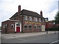
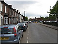
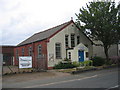
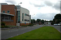
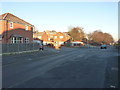
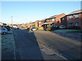
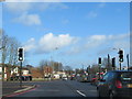
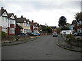
Photos of B71 1HB


Area Information
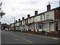
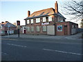
Living in B71 1HB, part of Hateley Heath in West Bromwich, means inhabiting a compact residential cluster with a population of 2,358 spread across 8,304 square metres. This area, shaped by post-war council housing developments from the 1940s and 1950s, reflects a history of social housing with ongoing community-driven improvements. The high population density—283,975 people per square kilometre—creates a tightly knit environment, though the area’s character is defined by its urban layout and proximity to local amenities. Recent years have seen efforts to address past challenges, including crime and infrastructure, with a focus on safer streets and greener spaces. Residents benefit from proximity to retail, transport, and community hubs, though the area’s legacy of 20th-century housing remains evident. For those seeking a compact, connected neighbourhood with practical access to services, B71 1HB offers a blend of historical context and modern-day convenience.
- Area Type
- Postcode
- Area Size
- 8304 m²
- Population
- 2358
- Population Density
- 4653 people/km²
The property market in B71 1HB is dominated by houses, with 44% of residents owning their homes. This suggests a rental market with a significant proportion of the housing stock available for let, though the exact balance between owner-occupied and rental properties is not specified. The area’s history of post-war council housing means many properties are older, potentially requiring maintenance or renovation. As a small residential cluster, the housing stock is limited in scale, which may affect availability and competition for buyers. The predominance of houses over flats indicates a preference for larger, family-oriented living spaces, though the compact size of the area means proximity to amenities is a key feature. Buyers should consider the age and condition of properties, as well as the area’s ongoing community-led improvements.
House Prices in B71 1HB
No properties found in this postcode.
Energy Efficiency in B71 1HB
Residents of B71 1HB have access to a range of amenities within practical reach. The area’s retail options include Aldi Tildasley, Lidl West, and Morrisons Daily, providing essential shopping for groceries and household items. Metro stops such as Black Lake and Dudley Street Guns Village offer local transport links, while rail stations like Tame Bridge Parkway and Bescot Stadium Railway Station connect to broader networks. These facilities contribute to a convenient lifestyle, allowing residents to manage daily errands and commute efficiently. The presence of multiple retail and transport hubs suggests a focus on accessibility, though the area’s urban character means green spaces and leisure options are less prominent. Nonetheless, the compact layout ensures services are close, supporting a practical, community-oriented way of life.
Amenities
Schools
| Rank | School | Type | Entry gender | Ages |
|---|
Explore more schools in this area
Go to Schools tabDemographics
The community in B71 1HB is predominantly composed of adults aged 30–64, with a median age of 47. Home ownership here is relatively low at 44%, indicating a rental-dominated market. The area is characterised by houses rather than flats, reflecting its origins in mid-20th-century council housing. The predominant ethnic group is White, though specific diversity data is not provided. The high population density—283,975 people per square kilometre—suggests a compact, possibly multi-generational living environment. While no explicit deprivation metrics are stated, the area’s history of housing refurbishments and community projects in the 2010s implies ongoing efforts to improve quality of life. The demographic profile suggests a mature, stable population with a focus on local amenities and connectivity.
Household Size
Accommodation Type
Tenure
Ethnic Group
Religion
Household Composition
Age
Household Deprivation
NS-SEC
Explore more demographic insights in this area
Go to Demographics tabPlanning
Planning Constraints
- Flood RiskPremium
- Ramsar Wetland SitesPremium
- Area of Outstanding Natural BeautyPremium
- Protected Nature ReservePremium
- Protected WoodlandPremium