Area Overview for B71 1EG
Photos of B71 1EG
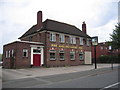
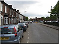
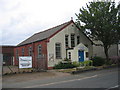

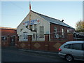
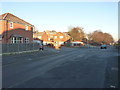
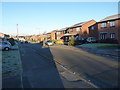
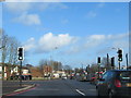
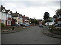
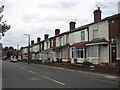
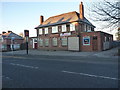

17 photos from this area
Area Information
Key information about the B71 1EG including its size, population, and administrative classification.
- Area Type
- Postcode
- Area Size
- 7556 m²
- Population
- 1802
- Population Density
- 6696 people/km²
House Prices in B71 1EG
24
Properties
£109,282
Average Sold Price
£35,000
Lowest Price
£156,000
Highest Price
Showing 24 properties
| Address | Type | Beds | Baths | Last Sale Price | Last Sale Date | |
|---|---|---|---|---|---|---|
| 12 Gladstone Street, West Bromwich, B71 1EG | house | - | - | £156,000 | Dec 2021 | |
| 4 Gladstone Street, West Bromwich, B71 1EG | Semi-detached | 3 | 1 | £132,350 | Dec 2018 | |
| 30 Gladstone Street, West Bromwich, B71 1EG | Bungalow | 2 | - | £122,000 | Oct 2014 | |
| 32 Gladstone Street, West Bromwich, B71 1EG | Semi-detached | 2 | - | £120,000 | Jan 2014 | |
| 44 Gladstone Street, West Bromwich, B71 1EG | Semi-detached | 2 | - | £112,500 | Jun 2013 | |
| 24 Gladstone Street, West Bromwich, B71 1EG | Semi-detached | 3 | 1 | £96,000 | Oct 2010 | |
| 16 Gladstone Street, West Bromwich, B71 1EG | house | - | - | £143,000 | Oct 2009 | |
| 26 Gladstone Street, West Bromwich, B71 1EG | Semi-detached | - | - | £114,000 | Jul 2008 | |
| 20 Gladstone Street, West Bromwich, B71 1EG | house | - | - | £144,995 | Jan 2007 | |
| 18 Gladstone Street, West Bromwich, B71 1EG | Semi-detached | 4 | 2 | £124,950 | Dec 2006 |
Page 1 of 3
Energy Efficiency in B71 1EG
Amenities
Schools
| Rank | School | Type | Entry gender | Ages |
|---|
Explore more schools in this area
Go to Schools tabDemographics
Household Size
Family (3-5 people)
most common
Accommodation Type
Houses
most common
Tenure
59
majority
Ethnic Group
White
most common
Religion
N/A
most common
Household Composition
N/A
most common
Age
47
median
Adults (30-64 years)
most common
Household Deprivation
N/A
with no deprivation
NS-SEC
16
in Lower managerial occupations
Explore more demographic insights in this area
Go to Demographics tabPlanning
Planning Constraints
- Flood RiskPremium
- Ramsar Wetland SitesPremium
- Area of Outstanding Natural BeautyPremium
- Protected Nature ReservePremium
- Protected WoodlandPremium