Area Overview for B71 1AF
Photos of B71 1AF
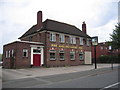
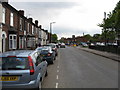
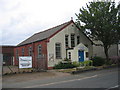
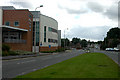
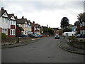
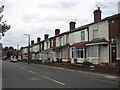
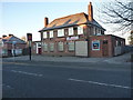
17 photos from this area
Area Information
Key information about the B71 1AF including its size, population, and administrative classification.
- Area Type
- Postcode
- Area Size
- 1.0 hectares
- Population
- 1801
- Population Density
- 5656 people/km²
House Prices in B71 1AF
33
Properties
£86,995
Average Sold Price
£33,000
Lowest Price
£155,000
Highest Price
Showing 33 properties
| Address | Type | Beds | Baths | Last Sale Price | Last Sale Date | |
|---|---|---|---|---|---|---|
| 158 Vicarage Road, West Bromwich, B71 1AF | Flat | 3 | - | £87,000 | May 2022 | |
| 188 Vicarage Road, West Bromwich, B71 1AF | Terraced | 2 | 1 | £80,000 | May 2022 | |
| 182 Vicarage Road, West Bromwich, B71 1AF | house | - | - | £150,000 | Nov 2021 | |
| 184 Vicarage Road, West Bromwich, B71 1AF | house | - | - | £155,000 | Sep 2021 | |
| 104 Vicarage Road, West Bromwich, B71 1AF | house | - | - | £90,000 | Dec 2017 | |
| 186 Vicarage Road, West Bromwich, B71 1AF | house | 2 | - | £85,000 | Jan 2013 | |
| 174 Vicarage Road, West Bromwich, B71 1AF | house | - | - | £64,000 | Sep 2012 | |
| 178 Vicarage Road, West Bromwich, B71 1AF | Terraced | 3 | 1 | £100,000 | Nov 2007 | |
| 144 Vicarage Road, West Bromwich, B71 1AF | Semi-detached | - | - | £70,000 | Dec 2006 | |
| 108 Vicarage Road, West Bromwich, B71 1AF | Terraced | - | - | £33,000 | Dec 1999 |
Page 1 of 4
Energy Efficiency in B71 1AF
Amenities
Schools
| Rank | School | Type | Entry gender | Ages |
|---|
Explore more schools in this area
Go to Schools tabDemographics
Household Size
Family (3-5 people)
most common
Accommodation Type
Houses
most common
Tenure
49
majority
Ethnic Group
White
most common
Religion
N/A
most common
Household Composition
N/A
most common
Age
47
median
Adults (30-64 years)
most common
Household Deprivation
N/A
with no deprivation
NS-SEC
16
in Lower managerial occupations
Explore more demographic insights in this area
Go to Demographics tabPlanning
Planning Constraints
- Flood RiskPremium
- Ramsar Wetland SitesPremium
- Area of Outstanding Natural BeautyPremium
- Protected Nature ReservePremium
- Protected WoodlandPremium