Area Overview for B70 9SS
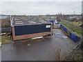
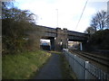
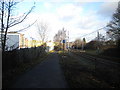
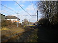
Photos of B70 9SS


Area Information
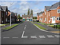
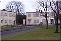
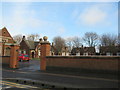
Living in B70 9SS means being part of a small, tightly knit residential cluster in West Bromwich, a town with deep industrial roots. The area is part of the Sandwell Metropolitan Borough, situated 8 miles west of Birmingham’s city centre. With a population of 2,234, it reflects the broader character of West Bromwich, a town shaped by its history as a coaching road stop in the 18th century and its role in the Black Country’s industrial past. Daily life here is influenced by proximity to retail hubs like Aldi Tildasley and Lidl West, as well as transport links such as Sandwell & Dudley Railway Station. The area’s compact size means residents have easy access to local amenities, though its small footprint also means community dynamics are closely interwoven. West Bromwich’s identity as home to West Bromwich Albion Football Club adds a distinct cultural layer, with the club’s 1878 founding by local industrial workers echoing the town’s heritage. For buyers, B70 9SS offers a snapshot of a town balancing historical legacy with modern infrastructure, though its challenges—like high crime risk—must be weighed against its practical advantages.
- Area Type
- Postcode
- Area Size
- Not available
- Population
- Not available
- Population Density
- Not available
The property market in B70 9SS is characterised by a 35% home ownership rate, suggesting that a majority of properties are rented rather than owned. This aligns with broader trends in areas with historical industrial backgrounds, where rental demand may be driven by commuters or transient populations. The accommodation type is primarily houses, which may indicate a focus on family homes or larger properties, though the small population of 2,234 implies limited housing stock. For buyers, this small area’s property market may offer limited scope for investment, with fewer options compared to larger urban centres. The presence of houses rather than flats or apartments could appeal to those seeking more space, but the low home ownership rate suggests competition for available properties. Buyers should consider the area’s proximity to transport links and amenities when evaluating its appeal.
House Prices in B70 9SS
No properties found in this postcode.
Energy Efficiency in B70 9SS
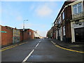
Residents of B70 9SS have access to a range of amenities within walking or short driving distance. Retail options include Aldi Tildasley, Lidl West, and M&S Astle, offering everyday shopping needs. The area’s proximity to rail stations like Dudley Street Guns Village and Black Lake provides easy access to public transport, while nearby leisure spots such as Dartmouth Street suggest opportunities for dining or socialising. The presence of five rail stations and five metro stops indicates a well-connected environment, though the specific character of these venues is not detailed. For families, the area’s compact nature means amenities are concentrated, reducing the need for long commutes. However, the absence of named parks or recreational facilities in the data means the extent of green space is unclear. Overall, the lifestyle in B70 9SS balances practicality with the convenience of nearby services.
Amenities
Schools
| Rank | School | Type | Entry gender | Ages |
|---|
Explore more schools in this area
Go to Schools tabDemographics
The community in B70 9SS is predominantly composed of adults aged 30–64, with a median age of 47. This suggests a population skewed towards middle-aged residents, likely including professionals, families, and retirees. Home ownership stands at 35%, indicating a mix of owner-occupied and rental properties, though the exact proportion of renters is not specified. The area’s accommodation is largely houses, which may reflect a preference for larger living spaces in a town with a history of industrial housing. The predominant ethnic group is White, though no data is provided on the proportion of other ethnicities. The absence of specific figures on deprivation or socioeconomic status means the area’s quality of life cannot be fully assessed, but the demographic profile suggests a stable, middle-aged population with established ties to the region.
Household Size
Accommodation Type
Tenure
Ethnic Group
Religion
Household Composition
Age
Household Deprivation
NS-SEC
Explore more demographic insights in this area
Go to Demographics tabPlanning
Planning Constraints
- Flood RiskPremium
- Ramsar Wetland SitesPremium
- Area of Outstanding Natural BeautyPremium
- Protected Nature ReservePremium
- Protected WoodlandPremium