Area Overview for B70 9SF
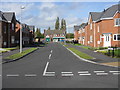
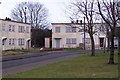
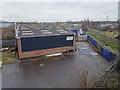
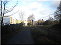
Photos of B70 9SF


Area Information
Living in B70 9SF means being part of a small, tightly knit residential cluster within West Bromwich, a town with deep industrial roots. The postcode area has a population of 2,234, reflecting its compact nature. West Bromwich itself lies 8 miles west of Birmingham’s city centre, distinguished by its “West” prefix from nearby Castle Bromwich. The area’s character is shaped by its history as a coaching road stop in the 18th century and its role in the 1974 formation of the Sandwell Metropolitan Borough. Residents here benefit from proximity to West Bromwich’s town centre, where the Ringway circulates key shopping areas. The local community is defined by its blend of historical legacy and modern infrastructure, with Sandwell District General Hospital and the West Bromwich Albion Football Club adding to the town’s identity. Daily life here balances practicality with cultural anchors, though the area’s small size means amenities are concentrated within a short walk or drive.
- Area Type
- Postcode
- Area Size
- Not available
- Population
- Not available
- Population Density
- Not available
The property market in B70 9SF is characterised by a 35% home ownership rate, with houses being the predominant accommodation type. This suggests a residential area where owner-occupation is possible but not dominant, leaving a notable portion of the housing stock available for rental. Given the small size of the postcode area, the housing stock is likely limited, meaning buyers may need to consider nearby areas for more options. The presence of houses rather than flats or apartments indicates a focus on family-friendly or long-term living arrangements. For buyers, this means competition for available properties could be high, particularly for those seeking owner-occupied homes. The limited scale of the area also means that local property values may be influenced more by broader trends in West Bromwich than by unique local factors.
House Prices in B70 9SF
No properties found in this postcode.
Energy Efficiency in B70 9SF
Residents of B70 9SF have access to a range of nearby amenities, including five retail outlets such as Aldi Tildasley, Lidl West, and M&S Astle, which cater to daily shopping needs. The area’s proximity to five metro stops, including Dudley Street Guns Village and Black Lake, provides easy access to public transport and local services. Rail connectivity is robust, with five stations offering links to Sandwell and Dudley. While specific parks or leisure facilities are not detailed in the data, the presence of multiple retail and transport hubs suggests a practical, convenience-focused lifestyle. The area’s compact nature means amenities are within practical reach, supporting a self-contained daily life. This mix of retail, transport, and connectivity options ensures residents can meet most needs without venturing far from home.
Amenities
Schools
| Rank | School | Type | Entry gender | Ages |
|---|
Explore more schools in this area
Go to Schools tabDemographics
The population of B70 9SF has a median age of 47, with the most common age range being adults aged 30–64. This suggests a mature, stable community with a focus on established households. Home ownership stands at 35%, indicating a mix of owner-occupied and rental properties. The predominant accommodation type is houses, reflecting a residential area with a more traditional housing stock. The predominant ethnic group is White, which aligns with broader demographic trends in Sandwell. While specific data on deprivation is absent, the relatively high median age and home ownership rate suggest a community with established financial stability. However, the 35% home ownership rate also implies that a significant portion of the population may be renting, which could influence the local rental market and housing availability.
Household Size
Accommodation Type
Tenure
Ethnic Group
Religion
Household Composition
Age
Household Deprivation
NS-SEC
Explore more demographic insights in this area
Go to Demographics tabPlanning
Planning Constraints
- Flood RiskPremium
- Ramsar Wetland SitesPremium
- Area of Outstanding Natural BeautyPremium
- Protected Nature ReservePremium
- Protected WoodlandPremium