Area Overview for B70 9RE
Photos of B70 9RE


Area Information
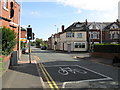
Living in B70 9RE means inhabiting a small, tightly knit residential cluster in the heart of West Bromwich, part of the Sandwell Metropolitan Borough. The area’s character is shaped by interwar and post-war housing developments, with a mix of private and council properties built between 1920 and 1970. A population of 1,950 residents lives in a compact, urban environment, surrounded by the industrial legacy of the Black Country. Despite ongoing demolitions of older homes for modern replacements, the area retains a working-class identity, with strong community ties evident in local initiatives like the Lyng Community Association. Proximity to the Walsall Canal and nearby railway stations, such as Sandwell & Dudley, offers practical connectivity. The blend of historical architecture, like the Grade II* listed Oak House, and contemporary amenities creates a distinct local identity. For buyers, B70 9RE represents a compact, affordable option in a region undergoing gradual regeneration.
- Area Type
- Postcode
- Area Size
- Not available
- Population
- 1950
- Population Density
- Not available
The property market in B70 9RE is defined by a 47% home ownership rate, with houses forming the predominant accommodation type. This suggests a market skewed toward owner-occupied properties rather than rentals, though the small area’s limited housing stock may create competition among buyers. The mix of interwar and post-war housing, alongside some pre-First World War buildings, offers a range of architectural styles and potential for renovation. However, ongoing demolitions of older properties for modern replacements indicate a dynamic but uneven market. For buyers, the area’s compact size and focus on houses may appeal to families seeking space, though affordability and long-term value depend on the condition of individual properties. Proximity to rail links and amenities adds practical appeal, but the working-class demographic may influence property pricing trends.
House Prices in B70 9RE
No properties found in this postcode.
Energy Efficiency in B70 9RE
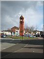
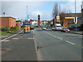
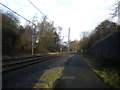
Residents of B70 9RE enjoy a range of nearby amenities within practical reach. Retail options include Aldi Tildasley, Lidl West, and M&S Astle, offering everyday shopping convenience. The area’s metro hubs, such as Dudley Street Guns Village and Dartmouth Street, provide access to local services and community spaces. Rail stations like Sandwell & Dudley connect to Birmingham’s transport network, while the Walsall Canal adds a recreational element. Marl Hole Park, a former clay pit, offers open green space for leisure, and the Oak House, a historic listed building, contributes to the area’s cultural heritage. These amenities create a balanced lifestyle, blending practicality with pockets of natural and historical interest, though the urban setting means limited large-scale leisure facilities.
Amenities
Schools
Residents of B70 9RE have access to three primary schools: Ryders Green Primary School, Ryders Green Junior School, and Ryders Green Infant School. Ryders Green Primary School holds an Ofsted rating of ‘good’, while the others lack formal ratings. The concentration of primary schools in the area provides convenience for families, though secondary education options are not specified in the data. The presence of multiple primary schools suggests a focus on early education, which may appeal to buyers prioritising family-friendly environments. However, the absence of secondary schools nearby could necessitate commuting for older children. The quality of primary education, particularly at Ryders Green Primary, may be a key factor for homebuyers considering the area’s long-term suitability for growing families.
| Rank | School | Type | Entry gender | Ages |
|---|
Explore more schools in this area
Go to Schools tabDemographics
The community in B70 9RE is predominantly composed of adults aged 30–64, with a median age of 47. Home ownership rates stand at 47%, reflecting a mix of owner-occupied and rental properties. The area’s accommodation is largely houses, a rarity in modern urban settings, suggesting a preference for family homes. The predominant ethnic group is White, though no specific diversity statistics are provided. The presence of council housing and ongoing demolitions indicates some deprivation, but the area’s working-class character is balanced by community-led regeneration efforts. This demographic profile suggests a stable, middle-aged population with established ties to the area. For buyers, the housing stock’s age and type may influence property value trends, with potential for both renovation and long-term investment.
Household Size
Accommodation Type
Tenure
Ethnic Group
Religion
Household Composition
Age
Household Deprivation
NS-SEC
Explore more demographic insights in this area
Go to Demographics tabPlanning
Planning Constraints
- Flood RiskPremium
- Ramsar Wetland SitesPremium
- Area of Outstanding Natural BeautyPremium
- Protected Nature ReservePremium
- Protected WoodlandPremium
- Crime RiskPremium