Area Overview for B70 9PY
Photos of B70 9PY

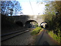
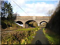
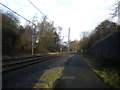
32 photos from this area
Area Information
Key information about the B70 9PY including its size, population, and administrative classification.
- Area Type
- Postcode
- Area Size
- 6897 m²
- Population
- 1817
- Population Density
- 5957 people/km²
House Prices in B70 9PY
28
Properties
£125,545
Average Sold Price
£65,000
Lowest Price
£198,000
Highest Price
Showing 28 properties
| Address | Type | Beds | Baths | Last Sale Price | Last Sale Date | |
|---|---|---|---|---|---|---|
| 85 Wood Lane, West Bromwich, B70 9PY | house | - | - | £198,000 | Dec 2022 | |
| 83 Wood Lane, West Bromwich, B70 9PY | Retail | 3 | 1 | £198,000 | Dec 2022 | |
| 95 Wood Lane, West Bromwich, B70 9PY | Retail | 3 | 1 | £187,000 | May 2022 | |
| 97 Wood Lane, West Bromwich, B70 9PY | Terraced | 3 | 1 | £138,000 | May 2019 | |
| 93 Wood Lane, West Bromwich, B70 9PY | house | - | - | £130,000 | Dec 2018 | |
| 81 Wood Lane, West Bromwich, B70 9PY | Terraced | 3 | 1 | £133,000 | Nov 2018 | |
| 69 Wood Lane, West Bromwich, B70 9PY | house | 3 | - | £80,000 | Aug 2015 | |
| 65 Wood Lane, West Bromwich, B70 9PY | house | - | - | £65,000 | Apr 2008 | |
| 63 Wood Lane, West Bromwich, B70 9PY | Semi-detached | 3 | - | £72,000 | Aug 2007 | |
| 75 Wood Lane, West Bromwich, B70 9PY | Terraced | - | - | £93,000 | Feb 2006 |
Page 1 of 3
Energy Efficiency in B70 9PY
Amenities
Schools
| Rank | School | Type | Entry gender | Ages |
|---|
Explore more schools in this area
Go to Schools tabDemographics
Household Size
Family (3-5 people)
most common
Accommodation Type
Houses
most common
Tenure
46
majority
Ethnic Group
White
most common
Religion
N/A
most common
Household Composition
N/A
most common
Age
47
median
Adults (30-64 years)
most common
Household Deprivation
N/A
with no deprivation
NS-SEC
13
in Lower managerial occupations
Explore more demographic insights in this area
Go to Demographics tabPlanning
Planning Constraints
- Flood RiskPremium
- Ramsar Wetland SitesPremium
- Area of Outstanding Natural BeautyPremium
- Protected Nature ReservePremium
- Protected WoodlandPremium