Area Overview for B70 9PN
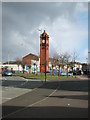
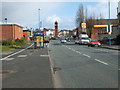
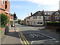
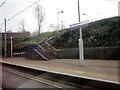
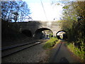
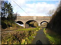
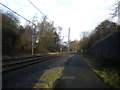
Photos of B70 9PN

Area Information
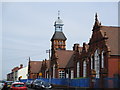
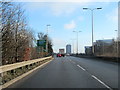
Living in B70 9PN means being part of a small, defined residential cluster in the West Midlands, where the population of 1950 reflects a tightly knit community. The area sits within Greets Green and Lyng Ward, historically shaped by interwar and post-war housing developments, with a mix of private and council properties. While some pre-First World War buildings remain, modern replacements are emerging through ongoing regeneration. The area’s character blends working-class roots with community-led redevelopment, creating a space where older homes sit alongside newer, mixed-tenure housing. Daily life here is shaped by proximity to local schools, rail links, and retail hubs, while the surrounding Black Country landscape offers a contrast to the urban residential feel. Residents benefit from practical transport options, including nearby railway stations and the Walsall Canal, which runs through the district. The area’s history as the birthplace of West Bromwich Albion Football Club adds a layer of local pride, though challenges like council housing and ongoing demolitions highlight the need for balance between preservation and progress.
- Area Type
- Postcode
- Area Size
- Not available
- Population
- 1950
- Population Density
- 3483 people/km²
The property market in B70 9PN is characterised by a 47% home ownership rate, indicating that nearly half of properties are owner-occupied, while the remaining 53% are likely rental or leasehold. The area’s accommodation type is predominantly houses, reflecting a traditional residential pattern rather than high-density housing. This suggests a focus on family homes, though the mix of private and council properties hints at a varied market. Given the small size of the postcode area, the housing stock is limited, with ongoing demolitions of older properties for modern replacements. Buyers should consider the proximity to local amenities, including schools and transport links, which enhance the area’s appeal. However, the relatively low home ownership rate may indicate a stronger rental market, potentially affecting property value stability. Prospective buyers should also note the interwar and post-war housing stock, which may require maintenance or renovation.
House Prices in B70 9PN
No properties found in this postcode.
Energy Efficiency in B70 9PN
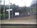
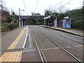
Life in B70 9PN is shaped by its proximity to essential amenities, including retail hubs, transport links, and community spaces. The area has five retail outlets within reach, such as Aldi Tildasley and M&S Astle, offering everyday shopping needs. Metro stops like Dudley Street Guns Village and Lodge Road provide access to local transport, while rail stations connect to Birmingham and beyond. Parks and green spaces are limited in the immediate area, but Marl Hole Park, colloquially known as “Marl ‘ole,” is nearby, offering a recreational space bounded by Hambletts Road and Gads Lane. The Walsall Canal runs through the district, adding a waterway element to the landscape. The area’s character is defined by its mix of older and newer housing, with community-led initiatives in Lyng Ward enhancing local pride. While not a bustling commercial centre, the practical reach of amenities supports a convenient, low-maintenance lifestyle for residents.
Amenities
Schools
Residents of B70 9PN have access to three primary schools within the area: Ryders Green Primary School, Ryders Green Junior School, and Ryders Green Infant School. All are primary-level institutions, catering to younger children and offering a range of educational stages. Ryders Green Primary School holds a good Ofsted rating, suggesting a solid standard of education, while the other two schools are listed without specific ratings. The concentration of primary schools indicates a family-friendly environment, with proximity to educational facilities a key consideration for homebuyers. The presence of multiple schools within a short distance reduces the need for long commutes, supporting a community-oriented lifestyle. For families, this cluster of schools provides options for early education, though parents may need to investigate further details about individual curricula or performance metrics beyond the Ofsted ratings provided.
| Rank | School | Type | Entry gender | Ages |
|---|
Explore more schools in this area
Go to Schools tabDemographics
The community in B70 9PN is predominantly composed of adults aged 30–64, with a median age of 47. This suggests a stable population with established households, though younger families are less represented. Home ownership stands at 47%, indicating a mix of owner-occupied and rental properties. The area’s accommodation is largely houses, reflecting a traditional residential layout rather than flats or apartments. The predominant ethnic group is White, which aligns with broader trends in the region. While no specific deprivation data is provided, the presence of council housing and ongoing demolitions implies some economic challenges. However, the community-led regeneration efforts in Lyng Ward, including mixed-tenure redevelopment, suggest a focus on improving quality of life through modern infrastructure and economic diversity. This balance of older stock and newer developments shapes a lived-in, evolving environment.
Household Size
Accommodation Type
Tenure
Ethnic Group
Religion
Household Composition
Age
Household Deprivation
NS-SEC
Explore more demographic insights in this area
Go to Demographics tabPlanning
Planning Constraints
- Flood RiskPremium
- Ramsar Wetland SitesPremium
- Area of Outstanding Natural BeautyPremium
- Protected Nature ReservePremium
- Protected WoodlandPremium