Area Overview for B70 9LF
Photos of B70 9LF


Area Information
Living in B70 9LF means being part of a small, residential cluster within West Bromwich, a town with a distinct industrial heritage. The area’s population of 2,234 residents is modest, reflecting its compact nature. West Bromwich itself lies 8 miles west of Birmingham’s city centre, offering a blend of historical character and modern convenience. The town’s name distinguishes it from nearby Castle Bromwich, and its central location connects it to broader regional networks. Daily life here is shaped by its proximity to key amenities, including retail hubs, rail stations, and healthcare facilities. The area’s compact size fosters a tight-knit community, though it remains part of the larger Sandwell Borough, which merged in 1974. Residents benefit from nearby landmarks such as West Bromwich Albion Football Club and Sandwell District General Hospital, which opened in 1978. While the area lacks the density of a major city, it offers a quieter alternative with practical access to transport and services.
- Area Type
- Postcode
- Area Size
- Not available
- Population
- Not available
- Population Density
- Not available
The property market in B70 9LF is defined by a 35% home ownership rate, suggesting that a majority of properties are rented rather than owned. The accommodation type is predominantly houses, which may indicate a focus on larger, family-friendly homes. Given the small size of the area, the housing stock is likely limited, potentially making it challenging for buyers to find options within the immediate vicinity. The lower home ownership rate could also mean greater competition for available properties, especially among first-time buyers or those seeking to move into the area. For those considering purchasing, the emphasis on houses may appeal to families or individuals prioritising space. However, the compact nature of B70 9LF means that buyers may need to look beyond the immediate postcode for more extensive housing choices.
House Prices in B70 9LF
No properties found in this postcode.
Energy Efficiency in B70 9LF
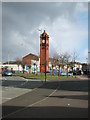
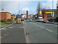
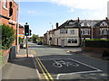
Residents of B70 9LF have access to a range of amenities within practical reach. Local retail options include Lidl West, Aldi Tildasley, and M&S Astle, offering everyday shopping needs. The area’s proximity to rail stations and metro stops, such as Lodge Road and Dudley Street Guns Village, ensures convenient travel for work or leisure. West Bromwich’s town centre features West Bromwich Ringway, which connects to main shopping areas, while healthcare facilities like Sandwell District General Hospital provide essential services. The presence of West Bromwich Albion Football Club adds a cultural dimension, with the stadium on Birmingham Road serving as a focal point for local activity. These amenities collectively create a lifestyle that balances practicality with community engagement, making daily life in B70 9LF both functional and connected.
Amenities
Schools
| Rank | School | Type | Entry gender | Ages |
|---|
Explore more schools in this area
Go to Schools tabDemographics
The population of B70 9LF has a median age of 47, with the most common age range being adults aged 30–64. This suggests a community skewed towards middle-aged individuals, likely including families and professionals. Home ownership in the area stands at 35%, indicating a mix of owner-occupied properties and rental units. The predominant accommodation type is houses, which may reflect a focus on family homes or larger residences. The predominant ethnic group is White, though no specific diversity statistics are provided. The relatively low home ownership rate could imply a higher proportion of renters, potentially affecting the local housing market’s dynamics. This demographic profile shapes the area’s character, with a focus on stability and long-term residency rather than transient populations.
Household Size
Accommodation Type
Tenure
Ethnic Group
Religion
Household Composition
Age
Household Deprivation
NS-SEC
Explore more demographic insights in this area
Go to Demographics tabPlanning
Planning Constraints
- Flood RiskPremium
- Ramsar Wetland SitesPremium
- Area of Outstanding Natural BeautyPremium
- Protected Nature ReservePremium
- Protected WoodlandPremium