Area Overview for B70 9DW
Photos of B70 9DW


Area Information
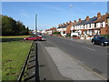
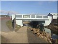
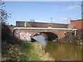
Living in B70 9DW means inhabiting a compact residential cluster within the Greets Green and Lyng Ward of West Bromwich. With a population of 2,068 and a density of 1,483 people per square kilometre, this area reflects a tightly knit community shaped by interwar and post-war housing developments. Much of the housing stock dates to between 1920 and 1970, with a mix of private and council properties, alongside some pre-First World War buildings. The area’s character is defined by its urban residential layout, surrounded by the industrial legacy of the Black Country. Despite ongoing demolitions of older stock, regeneration efforts since the 1990s have introduced mixed-tenure housing and community-led initiatives. Proximity to the Walsall Canal and the A41 motorway adds to its connectivity, while nearby railway stations offer links to Birmingham. The area retains a working-class identity, with a strong sense of local pride, though challenges remain in addressing deprivation. For buyers, B70 9DW offers a blend of historical charm and practical modernity, ideal for those seeking a compact, community-focused environment.
- Area Type
- Postcode
- Area Size
- Not available
- Population
- 2068
- Population Density
- 1483 people/km²
The property market in B70 9DW is dominated by houses, with 51% of residents owning their homes. This suggests a mix of owner-occupied and rental properties, though the exact proportion of rental stock is not specified. The housing stock is largely interwar and post-war in origin, with some pre-First World War buildings. This mix of older and modern properties creates a varied landscape, where buyers may find both traditional homes and newer developments. The area’s compact size means the immediate surroundings offer limited housing diversity, potentially restricting options for buyers seeking specific property types. The presence of council housing and ongoing demolitions indicates a need for regeneration, which could influence property values and availability. For those considering purchase, the market reflects a balance of affordability and historical character, though the working-class demographic may mean limited high-end property options.
House Prices in B70 9DW
No properties found in this postcode.
Energy Efficiency in B70 9DW
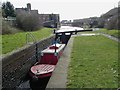
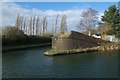
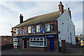
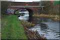
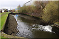
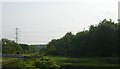
Residents of B70 9DW have access to a range of amenities within easy reach. The area’s five metro stops, including Dartmouth Street and Lodge Road, provide convenient public transport options, while five railway stations, such as Sandwell & Dudley and Langley Green, offer direct links to Birmingham. Retailers like Aldi Tildasley, Asda Great, and Lidl West cater to everyday shopping needs. The Walsall Canal runs through the area, offering a scenic waterway for leisure activities. Marl Hole Park, a former clay pit turned recreational space, provides greenery and outdoor space for residents. The mix of transport, shopping, and natural features contributes to a practical lifestyle, balancing urban convenience with access to nature and community hubs.
Amenities
Schools
The nearest school to B70 9DW is Newtown Primary School, a primary school with a good Ofsted rating. This institution serves the local community, offering education for younger children in the area. The absence of secondary schools nearby means families may need to consider commuting for higher education, though the primary school’s strong rating provides a solid foundation for early learning. The single school listed highlights the area’s focus on primary education, which could be a consideration for families with school-age children. The good Ofsted rating suggests a reliable and effective educational environment, though parents may need to supplement with extracurricular activities or secondary school options outside the immediate vicinity.
| Rank | School | Type | Entry gender | Ages |
|---|
Explore more schools in this area
Go to Schools tabDemographics
The community in B70 9DW is predominantly middle-aged, with a median age of 47 and the most common age range being adults aged 30–64. Home ownership rates stand at 51%, indicating a balanced mix of owner-occupied and rental properties. The area is characterised by houses rather than flats, reflecting a traditional housing stock. The predominant ethnic group is White, aligning with broader regional demographics. The working-class feel of the area, evidenced by council housing and ongoing demolitions, suggests a community grappling with some levels of deprivation. However, this is tempered by strong local ties and community-led regeneration efforts. The age profile implies a population focused on stability and family life, with limited presence of younger or older demographics. For prospective residents, this means a neighbourhood with established social networks but potential challenges in accessing newer amenities or services tailored to different age groups.
Household Size
Accommodation Type
Tenure
Ethnic Group
Religion
Household Composition
Age
Household Deprivation
NS-SEC
Explore more demographic insights in this area
Go to Demographics tabPlanning
Planning Constraints
- Flood RiskPremium
- Ramsar Wetland SitesPremium
- Area of Outstanding Natural BeautyPremium
- Protected Nature ReservePremium
- Protected WoodlandPremium