Area Overview for B70 9DS
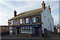
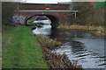
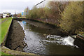
Photos of B70 9DS


Area Information
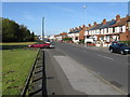
B70 9DS is a small, densely populated postcode area in England, home to 2,068 residents spread across 1.4 km². This compact cluster of housing sits within the broader Greets Green and Lyng Ward, a historically industrialised part of West Bromwich. The area’s character is shaped by interwar and post-war housing developments, with some older properties dating back to the pre-First World War era. Recent regeneration efforts have introduced mixed-tenure housing, though council estates and ongoing demolitions of older stock remain visible. The community has a working-class identity, with strong local ties and a history tied to West Bromwich Albion Football Club. Daily life here balances proximity to transport links with a sense of local pride, though challenges like high crime rates persist. For buyers, the area offers a compact, urban residential environment with direct access to rail networks and nearby amenities, though its small size means limited space for expansion.
- Area Type
- Postcode
- Area Size
- Not available
- Population
- 2068
- Population Density
- 1483 people/km²
The property market in B70 9DS is characterised by a 51% home ownership rate, suggesting that nearly half of residents rent their homes. The area’s housing stock is predominantly houses, though the exact proportion of flats or semi-detached properties is not detailed. This mix of ownership and rental options may appeal to buyers seeking affordable entry points, particularly in a small postcode area where land is limited. The presence of both private and council housing indicates a diverse market, with potential for investment in properties undergoing regeneration. However, the area’s small size and focus on existing housing stock mean limited scope for new developments. Buyers should consider the age of properties, with many built between the 1920s and 1970s, and the ongoing demolitions of older homes for modern replacements.
House Prices in B70 9DS
No properties found in this postcode.
Energy Efficiency in B70 9DS
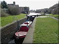
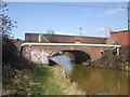
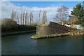
Residents of B70 9DS have access to a range of nearby amenities, including five retail outlets such as Sainsburys Oldbury, Iceland Oldbury, and Aldi Tildasley, providing everyday shopping convenience. The area’s rail network, with five stations including Sandwell & Dudley Railway Station, ensures easy access to Birmingham and surrounding towns. Locally, Marl Hole Park offers a recreational space, though its historical use as a clay pit for brick-making adds a unique character. The Walsall Canal, running through the district, provides a scenic element to the landscape. While the area lacks large-scale leisure facilities, its proximity to rail and retail hubs supports a practical lifestyle, balancing urban convenience with the constraints of a small postcode.
Amenities
Schools
The nearest school to B70 9DS is Newtown Primary School, which serves the area’s primary education needs. The school is listed as a primary institution with an Ofsted rating of ‘good’, indicating a satisfactory standard of teaching and facilities. As the only named school in the data, it suggests a limited range of educational options for families in the area. The absence of secondary schools or specialist provisions means parents may need to look beyond the immediate vicinity for secondary education. The ‘good’ rating reflects a baseline of quality, but families seeking a broader selection of schools may find the area’s offerings constrained compared to larger urban centres.
| Rank | School | Type | Entry gender | Ages |
|---|
Explore more schools in this area
Go to Schools tabDemographics
The population of B70 9DS is 2,068, with a median age of 47 and the majority of residents aged 30–64. This suggests a mature, settled community with a focus on family life and long-term residency. Home ownership here is relatively low at 51%, indicating a mix of rental properties and owner-occupied homes. The predominant accommodation type is houses, though the exact distribution of flats or terraced housing is not specified. The predominant ethnic group is White, with no data provided on minority representation. The area’s working-class demographic is reflected in its council housing stock and ongoing redevelopment projects. Deprivation is evident in the presence of older housing stock and the need for regeneration, though community initiatives like the Lyng Community Association have aimed to improve quality of life through mixed-tenure redevelopment.
Household Size
Accommodation Type
Tenure
Ethnic Group
Religion
Household Composition
Age
Household Deprivation
NS-SEC
Explore more demographic insights in this area
Go to Demographics tabPlanning
Planning Constraints
- Flood RiskPremium
- Ramsar Wetland SitesPremium
- Area of Outstanding Natural BeautyPremium
- Protected Nature ReservePremium
- Protected WoodlandPremium