Area Overview for B70 9DA
Photos of B70 9DA


Area Information
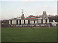
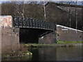
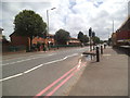
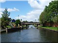
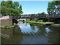
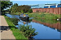
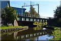
Living in B70 9DA means inhabiting a small, densely populated residential cluster in the heart of West Bromwich, part of the Greets Green and Lyng Ward area. With a population of 2,068 and a density of 1,483 people per square kilometre, this is a compact community shaped by interwar and post-war housing developments, with some pre-First World War buildings still standing. The area retains a working-class character, influenced by its history as part of the Black Country’s industrial heartland. Despite ongoing regeneration efforts, such as the Lyng Community Association’s mixed-tenure redevelopment, pockets of deprivation persist, reflected in the presence of council housing and ongoing demolitions. Yet, the area’s proximity to the Walsall Canal and Marl Hole Park offers green spaces amid urban living. Residents benefit from rail links to Birmingham New Street, with Sandwell & Dudley Railway Station just minutes away, and a range of local amenities, including supermarkets and community hubs. The blend of older and newer housing, coupled with a strong sense of local identity, defines daily life here.
- Area Type
- Postcode
- Area Size
- Not available
- Population
- 2068
- Population Density
- 1483 people/km²
The property market in B70 9DA is defined by a 51% home ownership rate, indicating a balanced mix of owner-occupied and rental properties. The accommodation type is primarily houses, suggesting a focus on family homes rather than apartments or flats. This housing stock reflects the area’s post-war development, with a blend of private and council properties. While the 51% ownership rate implies a significant portion of the market is available for rent, the presence of older housing stock and ongoing demolitions may affect property values and availability. Buyers should consider that the small area’s immediate surroundings likely share similar characteristics, with limited diversity in housing types. The working-class feel of the area, combined with pockets of regeneration, means properties may offer a mix of affordability and potential for future value growth, though demand is likely constrained by the area’s compact size and limited appeal to younger or high-income buyers.
House Prices in B70 9DA
No properties found in this postcode.
Energy Efficiency in B70 9DA
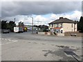
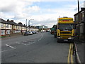
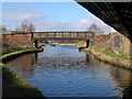
Life in B70 9DA is shaped by its urban residential character and proximity to amenities. Within practical reach are retail hubs like Sainsburys Oldbury and Aldi Tildasley, offering everyday shopping needs. The area’s transport links, including rail and metro stations, provide easy access to nearby towns and cities. Natural spaces include Marl Hole Park, a former clay pit turned recreational area, and the Walsall Canal, which adds a touch of greenery to the urban landscape. The Lyng Community Association’s regeneration efforts have enhanced the area’s appeal, fostering a sense of local pride. While the working-class roots of the area are evident, the mix of older and newer housing, combined with accessible amenities, creates a practical lifestyle. Residents can enjoy both the convenience of nearby services and the charm of historic sites like Oak House, a Grade II* listed building.
Amenities
Schools
The nearest school to B70 9DA is Newtown Primary School, which serves the local community with primary education. The school holds an Ofsted rating of ‘good’, indicating a satisfactory standard of teaching and facilities. As a primary school, it caters to children aged 4–11, making it a critical resource for families in the area. The absence of secondary schools in the immediate vicinity means students may need to travel to nearby towns for further education. The single primary school suggests a reliance on local provision, though the ‘good’ rating offers reassurance for parents seeking quality education. Families should consider the proximity of secondary schools when evaluating long-term suitability, as the area’s compact size may limit options for older children.
| Rank | School | Type | Entry gender | Ages |
|---|
Explore more schools in this area
Go to Schools tabDemographics
The community in B70 9DA is predominantly middle-aged, with a median age of 47 and the most common age range being adults aged 30–64. Home ownership accounts for 51% of households, suggesting a mix of owner-occupied and rental properties. The area is characterised by houses rather than flats, reflecting a traditional residential layout. The predominant ethnic group is White, though no specific data on diversity or minority representation is provided. The age profile indicates a stable population with limited youth or elderly demographics, which may influence local services and amenities. Deprivation is evident in the presence of council housing and ongoing housing stock replacements, which can affect quality of life. However, regeneration projects in Lyng have introduced economic diversity and higher design standards, offering some contrast to the area’s working-class roots.
Household Size
Accommodation Type
Tenure
Ethnic Group
Religion
Household Composition
Age
Household Deprivation
NS-SEC
Explore more demographic insights in this area
Go to Demographics tabPlanning
Planning Constraints
- Flood RiskPremium
- Ramsar Wetland SitesPremium
- Area of Outstanding Natural BeautyPremium
- Protected Nature ReservePremium
- Protected WoodlandPremium