Area Overview for B70 7EY
Photos of B70 7EY


Area Information
Living in B70 7EY means inhabiting a compact residential cluster in West Bromwich, part of the Sandwell Metropolitan Borough. The area’s population of 2,830 reflects its small-scale, tightly knit character. Historically shaped by interwar and post-war housing developments, it blends older properties with modern replacements, creating a mix of private and council homes. The area’s proximity to Greets Green and Lyng Ward ties it to the Black Country’s industrial past, though recent regeneration has introduced mixed-tenure housing and community-focused projects. Daily life here is defined by local amenities, including retail outlets like Farmfoods West and rail links to West Bromwich Central. While the area retains a working-class identity, community initiatives like the Lyng Community Association have fostered a sense of pride. Its strategic location near the A41 and Walsall Canal offers connectivity without the urban sprawl of larger cities, making it a practical choice for those seeking a balance between affordability and accessibility.
- Area Type
- Postcode
- Area Size
- Not available
- Population
- 2830
- Population Density
- Not available
The property market in B70 7EY is characterised by a 42% home ownership rate, indicating that less than half of properties are owner-occupied. The predominant accommodation type is houses, reflecting the area’s historical development of interwar and post-war housing. This suggests a mix of private and council properties, with ongoing regeneration projects replacing older stock. For buyers, this means a limited selection of owner-occupied homes, with a stronger rental market presence. The small area’s compact nature means property availability is constrained, though nearby areas like Lyng Ward may offer more options. The mix of housing types—some with pre-First World War origins—adds diversity to the market, though buyers should consider the potential for future redevelopment or demolition in certain parts of the area.
House Prices in B70 7EY
No properties found in this postcode.
Energy Efficiency in B70 7EY
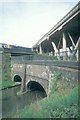
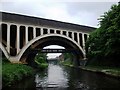
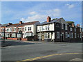
Life in B70 7EY is supported by a range of nearby amenities, including five retail outlets like Farmfoods West and Iceland West, ensuring access to everyday shopping. The area’s rail and metro stations, such as West Bromwich Central and Langley Green, connect residents to broader networks for commuting and leisure. Parks like Marl Hole Park, colloquially known as “Marl ’ole,” offer recreational space, while the Walsall Canal adds a scenic element. The presence of the Oak House, a Grade II* listed building, highlights the area’s historical charm. These amenities foster a convenient, community-focused lifestyle, blending practicality with local heritage.
Amenities
Schools
The nearest school to B70 7EY is Guns Village Infant School, a primary institution serving the local community. While no Ofsted rating is provided, the school’s presence underscores the area’s suitability for families with young children. The absence of secondary schools nearby may require parents to consider commuting to other parts of West Bromwich or Sandwell. The single primary school reflects the area’s small scale, though it aligns with the broader trend of community-led educational initiatives in the region. Families seeking a comprehensive range of schools may need to look beyond B70 7EY, but the proximity of basic education infrastructure supports daily life for local households.
| Rank | School | Type | Entry gender | Ages |
|---|
Explore more schools in this area
Go to Schools tabDemographics
The population of B70 7EY is predominantly adults aged 30–64, with a median age of 47. Home ownership stands at 42%, indicating a mix of owner-occupied and rental properties. The accommodation type is primarily houses, reflecting the area’s post-war housing stock. The predominant ethnic group is White, though specific diversity metrics are not detailed. The median age and ownership figures suggest a stable, middle-aged community with a moderate level of deprivation, evidenced by ongoing housing demolitions and council housing. This demographic profile implies a focus on family-oriented living, with older residents and working-age adults forming the core of the population. The lack of younger households may influence local services and amenities, though the area’s community spirit and regeneration efforts aim to address such challenges.
Household Size
Accommodation Type
Tenure
Ethnic Group
Religion
Household Composition
Age
Household Deprivation
NS-SEC
Explore more demographic insights in this area
Go to Demographics tabPlanning
Planning Constraints
- Flood RiskPremium
- Ramsar Wetland SitesPremium
- Area of Outstanding Natural BeautyPremium
- Protected Nature ReservePremium
- Protected WoodlandPremium
- Crime RiskPremium