Area Overview for B70 6WF
Photos of B70 6WF


Area Information
B70 6WF is a small residential postcode in West Bromwich, part of Sandwell in the West Midlands. With a population of 1,654, it reflects the character of a tight-knit community within a town steeped in industrial history. West Bromwich itself lies 8 miles west of Birmingham, distinguished by its “West” prefix from Castle Bromwich. The area benefits from proximity to key transport routes, including the A41 and Black Country Spine Road, which link it to broader regional networks. Daily life here is shaped by a mix of practicality and local identity, with the West Bromwich Albion Football Club nearby adding to the town’s cultural fabric. Residents have access to essential amenities, including five nearby railway stations and a range of retail options. While the area’s population is modest, its connectivity and historical roots make it a distinct microcosm of the Black Country’s evolving landscape.
- Area Type
- Postcode
- Area Size
- Not available
- Population
- 1654
- Population Density
- 2041 people/km²
The property market in B70 6WF is dominated by houses, with 59% of residents owning their homes. This suggests a stable, owner-occupied market rather than a high-rental area, though the small population means the housing stock is limited. The focus on houses implies larger properties, potentially appealing to families or those seeking space. However, the area’s size means buyers must consider proximity to amenities and transport links. Nearby railway stations, including Smethwick Galton Bridge and West Bromwich Central, add value for commuters. For buyers, the challenge lies in balancing the appeal of home ownership with the practicality of a compact postcode, where property choices are constrained by the small residential cluster.
House Prices in B70 6WF
No properties found in this postcode.
Energy Efficiency in B70 6WF
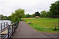
Living in B70 6WF offers access to a range of nearby amenities. Retail options include Heron West, Tesco West, and Spar, providing everyday shopping convenience. Five metro stops, such as Trinity Way and Kenrick Park, offer easy access to public transport, while three railway stations—Hawthorns, Smethwick Galton Bridge High Level, and Smethwick Rolfe Street—connect residents to broader networks. The area’s proximity to West Bromwich’s town centre, with its Ringway and Sandwell District General Hospital, adds to its practical appeal. While green spaces are not explicitly listed, the absence of planning constraints like AONB or protected woodlands suggests a focus on urban living. The mix of retail, transport, and healthcare facilities makes daily life efficient and accessible.
Amenities
Schools
| Rank | School | Type | Entry gender | Ages |
|---|
Explore more schools in this area
Go to Schools tabDemographics
The median age in B70 6WF is 47, with the majority of residents falling within the 30–64 age range. This suggests a community skewed toward adults, likely including families and professionals. Home ownership stands at 59%, indicating a mix of owner-occupied properties and rentals. The predominant accommodation type is houses, which aligns with the area’s residential character. The largest ethnic group is the Asian community, reflecting broader demographic trends in Sandwell. With a population of 1,654, the area is small enough to foster familiarity yet diverse enough to reflect regional patterns. The absence of specific deprivation data means quality of life is inferred from amenities and infrastructure, such as the 98 broadband score, which supports modern living needs.
Household Size
Accommodation Type
Tenure
Ethnic Group
Religion
Household Composition
Age
Household Deprivation
NS-SEC
Explore more demographic insights in this area
Go to Demographics tabPlanning
Planning Constraints
- Flood RiskPremium
- Ramsar Wetland SitesPremium
- Area of Outstanding Natural BeautyPremium
- Protected Nature ReservePremium
- Protected WoodlandPremium