Area Overview for B70 6WD
Photos of B70 6WD


Area Information
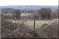
B70 6WD is a small, tightly knit residential postcode area in West Bromwich, part of the Sandwell borough in the West Midlands. With a population of just 1,654, it reflects the compact nature of the wider town, which has a long industrial history and a distinct identity. West Bromwich itself is 8 miles west of Birmingham, and B70 6WD sits within a cluster of homes that benefit from proximity to key transport routes and local amenities. The area is served by multiple railway stations, including Smethwick Galton Bridge and Smethwick Rolfe Street, linking residents to broader networks. Daily life here is shaped by a mix of traditional retail, such as Spar and Tesco West, and community hubs like Kenrick Park. The presence of West Bromwich Albion Football Club adds a local flavour, while the area’s connectivity to the A41 road ensures ease of travel. This postcode offers a blend of practicality and historical roots, ideal for those seeking a quieter residential setting with access to urban amenities.
- Area Type
- Postcode
- Area Size
- Not available
- Population
- 1654
- Population Density
- 2041 people/km²
The property market in B70 6WD is characterised by a 59% home ownership rate, with houses forming the majority of the accommodation stock. This suggests a market dominated by owner-occupied properties rather than rentals, likely reflecting the area’s traditional housing stock and appeal to long-term residents. Given the small size of the postcode, the housing options are limited to a cluster of homes, which may mean buyers need to consider nearby areas for more choice. The focus on houses rather than flats indicates a preference for family-friendly, private living spaces. For those seeking a home in this area, the compact nature of B70 6WD means proximity to local amenities and transport is a key advantage, though buyers should be mindful of the limited scale of the housing stock.
House Prices in B70 6WD
No properties found in this postcode.
Energy Efficiency in B70 6WD
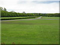
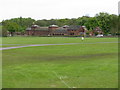
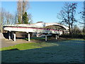
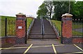
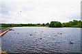
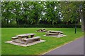
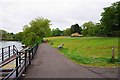
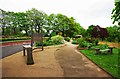
Living in B70 6WD offers access to a range of nearby amenities, including five retail outlets such as Tesco West and Spar, ensuring everyday shopping needs are met. The area is also close to Kenrick Park, a green space for recreation, and Trinity Way, a key thoroughfare linking to local services. Three railway stations—Hawthorns, Smethwick Galton Bridge, and Smethwick Rolfe Street—provide convenient access to public transport, while the A41 road ensures easy travel to Birmingham and beyond. The presence of West Bromwich Albion Football Club adds a cultural dimension, and the town’s historical infrastructure, including Sandwell District General Hospital, underscores its practical appeal. This mix of retail, green space, and transport options creates a balanced lifestyle for residents.
Amenities
Schools
| Rank | School | Type | Entry gender | Ages |
|---|
Explore more schools in this area
Go to Schools tabDemographics
The population of B70 6WD is 1,654, with a median age of 47, indicating a community skewed toward middle-aged adults. The most common age range is 30–64 years, suggesting a stable, working-age population. Home ownership stands at 59%, with houses being the predominant accommodation type. This points to a largely owner-occupied area with a focus on family homes. The predominant ethnic group is the Asian community, reflecting broader demographic trends in Sandwell. While no specific deprivation data is provided, the age profile and home ownership rates imply a relatively stable socioeconomic environment. The absence of younger or elderly demographics may influence local services and amenities, though the area’s proximity to retail and transport suggests practical support for daily needs.
Household Size
Accommodation Type
Tenure
Ethnic Group
Religion
Household Composition
Age
Household Deprivation
NS-SEC
Explore more demographic insights in this area
Go to Demographics tabPlanning
Planning Constraints
- Flood RiskPremium
- Ramsar Wetland SitesPremium
- Area of Outstanding Natural BeautyPremium
- Protected Nature ReservePremium
- Protected WoodlandPremium