Area Overview for B70 6WA
Photos of B70 6WA


Area Information
Living in B70 6WA means being part of a compact residential cluster in the heart of West Bromwich, a town with deep industrial roots in the West Midlands. The postcode covers 1,654 residents, reflecting a tight-knit community within a historically significant area. West Bromwich itself lies 8 miles west of Birmingham, distinguished by its “West” prefix from nearby Castle Bromwich. The town’s character is shaped by its industrial past, including the legacy of West Bromwich Albion Football Club, founded in 1878. Daily life here balances proximity to urban amenities with a quieter residential feel. The area is served by key transport routes like the A41 and Black Country Spine Road, linking it to broader regional networks. Residents benefit from nearby healthcare, including Sandwell District General Hospital, and a mix of local shops and public transport options. The postcode’s small size means it is part of a larger ward, West Bromwich Central, which has a population of 15,426 and is represented by three council members. This compact area offers a snapshot of the broader town’s evolving identity, blending heritage with modern infrastructure.
- Area Type
- Postcode
- Area Size
- Not available
- Population
- 1654
- Population Density
- 2041 people/km²
The property market in B70 6WA is dominated by owner-occupied homes, with 59% of residents living in properties they own. The predominant accommodation type is houses, which is unusual for urban areas and suggests a preference for single-family dwellings. This contrasts with the typical mix of flats and terraced houses found in more densely populated zones. The small size of the postcode means the housing stock is limited, but the focus on houses indicates a niche market for buyers seeking larger properties. Given the high home ownership rate, the area may have fewer rental properties, potentially making it less attractive to those seeking short-term or flexible housing. The presence of houses also implies a quieter, more private lifestyle compared to high-density developments. For buyers, this means a limited but distinct range of properties, with potential for long-term investment in a stable, family-oriented market. The proximity to transport links may also appeal to commuters, though the area’s compact nature means buyers must consider the broader West Bromwich context.
House Prices in B70 6WA
No properties found in this postcode.
Energy Efficiency in B70 6WA
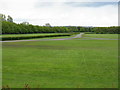
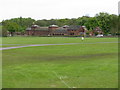
Residents of B70 6WA have access to a range of amenities within practical reach. The area includes five retail outlets, such as Tesco West and Spar, offering everyday shopping needs. Five metro stops, including Kenrick Park and West Bromwich Central, provide easy access to public transport, while rail stations like Smethwick Rolfe Street connect to broader networks. The town’s West Bromwich Ringway circulates key shopping areas, enhancing accessibility. Healthcare is well-supported by Sandwell District General Hospital, a major local facility. The area’s industrial heritage is complemented by modern conveniences, though recreational spaces are not explicitly detailed in the data. The proximity to the A41 and Black Country Spine Road ensures links to nearby towns and cities, supporting both leisure and commuting. While specific parks or leisure venues are not named, the presence of multiple transport and retail hubs suggests a functional, service-oriented lifestyle. This blend of connectivity and local amenities makes daily life practical for residents, whether for work, shopping, or travel.
Amenities
Schools
| Rank | A + A* % | School | Type | Entry gender | Ages |
|---|
Explore more schools in this area
Go to Schools tabDemographics
The population of B70 6WA has a median age of 47, with the most common age range being adults aged 30–64. This suggests a mature, stable community with a focus on family and long-term residency. Home ownership rates stand at 59%, indicating a mix of owner-occupied properties and rental units. The predominant accommodation type is houses, which aligns with the area’s residential character. The largest ethnic group is the Asian population, reflecting the broader demographic trends in Sandwell. While no specific deprivation data is provided, the age profile and ownership figures suggest a community with established roots. The presence of a significant Asian population adds to the cultural fabric of the area, though the data does not specify further diversity metrics. The median age also implies a workforce likely engaged in local industries or commuting to nearby Birmingham. This demographic profile shapes a community that values stability, with a focus on housing and family-oriented living.
Household Size
Accommodation Type
Tenure
Ethnic Group
Religion
Household Composition
Age
Household Deprivation
NS-SEC
Explore more demographic insights in this area
Go to Demographics tabPlanning
Planning Constraints
- Flood RiskLocked
- Ramsar Wetland SitesLocked
- Area of Outstanding Natural BeautyLocked
- Protected Nature ReserveLocked
- Protected WoodlandLocked
- Crime RiskLocked