Area Overview for B70 6RA
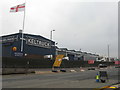
Photos of B70 6RA


Area Information
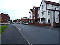
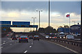
Living in B70 6RA means being part of a tightly knit residential cluster in West Bromwich, a town with deep industrial roots in the West Midlands. The postcode covers a small, densely populated area with 2,060 residents packed into 1.88 km², reflecting a compact, urban layout. West Bromwich itself lies 8 miles west of Birmingham’s city centre, offering proximity to the region’s economic and cultural hubs while retaining its own distinct character. The town’s history as a coaching road stop and its role in the 19th-century industrial boom shape its current identity, with landmarks like West Bromwich Albion Football Club and Sandwell District General Hospital anchoring daily life. Residents benefit from being near major transport routes like the A41 and the Black Country Spine Road, while the area’s proximity to Birmingham opens doors to broader opportunities. With a population skewed toward adults aged 30–64, B70 6RA is a place where established communities thrive, blending practicality with the legacy of a town that has weathered both industrial decline and modern challenges.
- Area Type
- Postcode
- Area Size
- Not available
- Population
- 2060
- Population Density
- 1107 people/km²
The property market in B70 6RA is characterised by a low home ownership rate of 27%, suggesting that the area is not a strong candidate for owner-occupied housing. Instead, the market is likely dominated by rental properties, catering to tenants rather than buyers seeking long-term investment. The accommodation type is predominantly flats, which aligns with the high population density and compact nature of the postcode. This makes B70 6RA a less attractive option for those prioritising spacious or detached homes, though it may appeal to individuals or families looking for affordable, centrally located housing. Given the area’s small size, the immediate surroundings may offer more variety in property types, but buyers should consider the limitations of the local stock. The low home ownership rate also implies that the area may not be ideal for those seeking equity growth or a stable, long-term investment in property.
House Prices in B70 6RA
No properties found in this postcode.
Energy Efficiency in B70 6RA
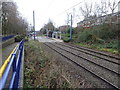
Residents of B70 6RA enjoy a range of amenities within practical reach. The area’s retail options include Spar, Heron West, and Farmfoods West, offering essential shopping and convenience services. For leisure and green space, Kenrick Park and Trinity Way provide accessible outdoor areas, while the nearby West Bromwich Central metro stop connects to broader urban hubs. The rail network, with stations like Smethwick Rolfe Street, ensures easy travel to Birmingham and surrounding areas. The presence of multiple retail and transport hubs suggests a community that balances daily practicalities with connectivity to larger cities. While the data does not specify dining or cultural venues, the proximity to major roads and transport links implies access to a wider array of services beyond the immediate postcode. This blend of local amenities and regional accessibility supports a lifestyle that is both self-sufficient and integrated into the broader West Midlands network.
Amenities
Schools
Residents of B70 6RA have access to two notable schools within reach: Sandwell Valley School, an independent institution with an outstanding Ofsted rating, and V.A.S.E Academy, another independent school rated as good. Both institutions cater to families seeking high-quality education, with Sandwell Valley’s top rating indicating excellence in teaching and outcomes. The presence of independent schools suggests a demand for private education, though no state-funded schools are listed in the data. This mix of school types offers families flexibility, though it may also reflect a community where private education is a priority. For those seeking state-funded options, further research would be needed, but the current data highlights a strong educational infrastructure in the area.
| Rank | School | Type | Entry gender | Ages |
|---|
Explore more schools in this area
Go to Schools tabDemographics
The demographic profile of B70 6RA is defined by a median age of 47, with the majority of residents falling into the 30–64 age bracket. This suggests a community of working-age adults, many of whom may be employed in nearby industrial or service sectors. Home ownership is relatively low at 27%, indicating that a significant portion of the population rents their homes. The accommodation type is predominantly flats, reflecting the area’s high population density of 1,107 people per km². The predominant ethnic group is White, though specific data on diversity beyond this is not provided. The age distribution and housing stock suggest a mature, stable population, but the low home ownership rate may indicate a reliance on rental markets or shared living arrangements. The absence of detailed data on deprivation or income levels means the area’s quality of life cannot be fully assessed, but the demographic makeup points to a community focused on practical living rather than high-end property ownership.
Household Size
Accommodation Type
Tenure
Ethnic Group
Religion
Household Composition
Age
Household Deprivation
NS-SEC
Explore more demographic insights in this area
Go to Demographics tabPlanning
Planning Constraints
- Flood RiskPremium
- Ramsar Wetland SitesPremium
- Area of Outstanding Natural BeautyPremium
- Protected Nature ReservePremium
- Protected WoodlandPremium