Area Overview for B70 6QL
Photos of B70 6QL


Area Information
Living in B70 6QL means being part of a small, densely populated residential cluster in West Bromwich, a town with a rich industrial history. The area’s 2060 residents, spread across 1.88 km², create a compact community with a median age of 47, dominated by adults aged 30–64. This suggests a mature demographic, likely with established careers and families. The postcode lies within West Bromwich Central Ward, a part of Sandwell, and is close to the town’s historical core, including the former coaching roads and modern transport routes like the A41. Daily life here balances proximity to urban amenities with a quieter, residential feel. The area’s small size means residents are likely within walking or short driving distance of local shops, schools, and transport hubs. With 27% home ownership and a predominance of flats, the housing stock reflects a mix of rental properties and owner-occupied units, typical of post-industrial towns. The presence of independent schools and rail links adds to the area’s appeal for families and commuters.
- Area Type
- Postcode
- Area Size
- Not available
- Population
- 2060
- Population Density
- 1107 people/km²
The property market in B70 6QL is defined by a 27% home ownership rate, with flats making up the majority of accommodation. This suggests a rental market that dominates, likely shaped by the area’s compact size and historical development patterns. The prevalence of flats may indicate older, purpose-built housing stock, which could appeal to buyers seeking affordable, low-maintenance properties. However, the limited number of owner-occupied homes may also mean fewer opportunities for long-term investment or equity growth. For buyers, the small area size means the immediate surroundings are critical—proximity to transport links and amenities is a key consideration. The flat-dominated market may also reflect a reliance on social housing or private rentals, which could affect property values and demand. Those seeking owner-occupied homes may need to look beyond the immediate postcode to find more options, as the area’s small footprint limits housing diversity.
House Prices in B70 6QL
No properties found in this postcode.
Energy Efficiency in B70 6QL
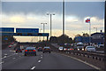
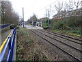
The lifestyle in B70 6QL is shaped by its proximity to a range of amenities, including five metro stops, five retail outlets, and five rail stations. Specific venues like Kenrick Park and Trinity Way offer green spaces and community hubs, while shops such as Spar and Iceland West provide everyday convenience. The rail stations, including Smethwick Rolfe Street and Hawthorns, connect residents to broader networks, facilitating travel to Birmingham and surrounding areas. The area’s compact size ensures that essential services are within walking or short driving distance, enhancing daily life. Parks and transport links contribute to a balanced lifestyle, blending urban accessibility with recreational opportunities. For residents, this means a mix of practicality and community engagement, with amenities that support both routine needs and leisure activities. The presence of multiple retail and transport options also suggests a vibrant, though small-scale, local economy.
Amenities
Schools
Residents of B70 6QL have access to two independent schools within practical reach: Sandwell Valley School, rated outstanding by Ofsted, and V.A.S.E Academy, rated good. Both institutions offer non-state education, which may appeal to families prioritising specific curricula or facilities. The presence of an outstanding-rated school suggests high-quality educational provision, though the absence of state schools means families must consider the financial commitment of independent education. The mix of school types reflects the area’s broader educational landscape, where private institutions coexist with public services. For parents seeking top-tier schooling, these options provide a clear advantage, but they also highlight the need for careful budgeting. The proximity of these schools to the postcode ensures ease of access for families, reinforcing the area’s suitability for households with children.
| Rank | School | Type | Entry gender | Ages |
|---|
Explore more schools in this area
Go to Schools tabDemographics
B70 6QL’s population of 2060 is characterised by a median age of 47, with the majority of residents aged 30–64. This suggests a community of working-age adults, many of whom may be in stable employment or nearing retirement. Only 27% of homes are owner-occupied, indicating a rental-heavy market, which could influence the social dynamics of the area. The accommodation type is predominantly flats, a common feature in post-industrial towns with limited space for larger properties. The predominant ethnic group is White, reflecting broader demographic trends in Sandwell. While no specific deprivation data is provided, the low home ownership rate and flat-dominated housing may suggest a reliance on rental income or social housing, which could impact long-term financial stability for some residents. The age profile indicates a mature population, which may influence local services and amenities tailored to older adults.
Household Size
Accommodation Type
Tenure
Ethnic Group
Religion
Household Composition
Age
Household Deprivation
NS-SEC
Explore more demographic insights in this area
Go to Demographics tabPlanning
Planning Constraints
- Flood RiskPremium
- Ramsar Wetland SitesPremium
- Area of Outstanding Natural BeautyPremium
- Protected Nature ReservePremium
- Protected WoodlandPremium