Area Overview for B70 6PL
Photos of B70 6PL

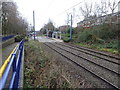
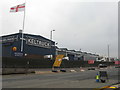
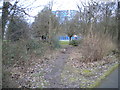
46 photos from this area
Area Information
Key information about the B70 6PL including its size, population, and administrative classification.
- Area Type
- Postcode
- Area Size
- 1.4 hectares
- Population
- 1654
- Population Density
- 2041 people/km²
House Prices in B70 6PL
69
Properties
£109,233
Average Sold Price
£24,500
Lowest Price
£200,000
Highest Price
Showing 69 properties
| Address | Type | Beds | Baths | Last Sale Price | Last Sale Date | |
|---|---|---|---|---|---|---|
| 14 Hope Street, West Bromwich, B70 6PL | Detached | 3 | 2 | £59,393 | Nov 2024 | |
| 31 Hope Street, West Bromwich, B70 6PL | Terraced | 3 | 1 | £145,000 | May 2024 | |
| 49 Hope Street, West Bromwich, B70 6PL | Terraced | 1 | - | £200,000 | Sep 2023 | |
| 11 Hope Street, West Bromwich, B70 6PL | house | - | - | £166,000 | Jan 2022 | |
| 10 Hope Street, West Bromwich, B70 6PL | house | 1 | 5 | £135,000 | Jul 2021 | |
| 21 Hope Street, West Bromwich, B70 6PL | Terraced | 3 | 2 | £136,000 | Sep 2019 | |
| 37 Hope Street, West Bromwich, B70 6PL | house | - | - | £140,000 | Sep 2018 | |
| 33 Hope Street, West Bromwich, B70 6PL | Terraced | 3 | 1 | £146,000 | Feb 2018 | |
| 23 Hope Street, West Bromwich, B70 6PL | Terraced | 4 | - | £165,000 | Jun 2016 | |
| 47 Hope Street, West Bromwich, B70 6PL | house | - | - | £78,833 | Mar 2013 |
Page 1 of 7
Energy Efficiency in B70 6PL
Amenities
Schools
| Rank | School | Type | Entry gender | Ages |
|---|
Explore more schools in this area
Go to Schools tabDemographics
Household Size
Family (3-5 people)
most common
Accommodation Type
Houses
most common
Tenure
59
majority
Ethnic Group
asian_total
most common
Religion
N/A
most common
Household Composition
N/A
most common
Age
47
median
Adults (30-64 years)
most common
Household Deprivation
N/A
with no deprivation
NS-SEC
23
in Lower managerial occupations
Explore more demographic insights in this area
Go to Demographics tabPlanning
Planning Constraints
- Flood RiskPremium
- Ramsar Wetland SitesPremium
- Area of Outstanding Natural BeautyPremium
- Protected Nature ReservePremium
- Protected WoodlandPremium