Area Overview for B70 6LR
Photos of B70 6LR

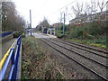
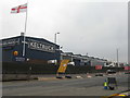
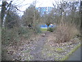
46 photos from this area
Area Information
Key information about the B70 6LR including its size, population, and administrative classification.
- Area Type
- Postcode
- Area Size
- 9372 m²
- Population
- 1883
- Population Density
- 4888 people/km²
House Prices in B70 6LR
36
Properties
£86,714
Average Sold Price
£24,500
Lowest Price
£238,000
Highest Price
Showing 36 properties
| Address | Type | Beds | Baths | Last Sale Price | Last Sale Date | |
|---|---|---|---|---|---|---|
| 15 Trinity Street, West Bromwich, B70 6LR | Terraced | 3 | 1 | £238,000 | Dec 2023 | |
| 21 Trinity Street, West Bromwich, B70 6LR | house | - | - | £101,000 | Jun 2017 | |
| 1 Trinity Street, West Bromwich, B70 6LR | house | 3 | - | £118,000 | Sep 2013 | |
| 7 Trinity Street, West Bromwich, B70 6LR | house | - | - | £105,000 | Oct 2011 | |
| 23 Trinity Street, West Bromwich, B70 6LR | house | 1 | 1 | £90,000 | Jun 2010 | |
| 33 Trinity Street, West Bromwich, B70 6LR | Terraced | - | - | £60,000 | Mar 2007 | |
| 29 Trinity Street, West Bromwich, B70 6LR | house | - | - | £100,000 | Jun 2006 | |
| 31 Trinity Street, West Bromwich, B70 6LR | Terraced | 2 | 2 | £87,500 | Oct 2005 | |
| 39 Trinity Street, West Bromwich, B70 6LR | Terraced | - | - | £88,500 | Sep 2004 | |
| 19 Trinity Street, West Bromwich, B70 6LR | Terraced | 3 | 1 | £66,500 | Mar 2003 |
Page 1 of 4
Energy Efficiency in B70 6LR
Amenities
Schools
| Rank | School | Type | Entry gender | Ages |
|---|
Explore more schools in this area
Go to Schools tabDemographics
Household Size
Family (3-5 people)
most common
Accommodation Type
Houses
most common
Tenure
42
majority
Ethnic Group
asian_total
most common
Religion
N/A
most common
Household Composition
N/A
most common
Age
47
median
Adults (30-64 years)
most common
Household Deprivation
N/A
with no deprivation
NS-SEC
12
in Lower managerial occupations
Explore more demographic insights in this area
Go to Demographics tabPlanning
Planning Constraints
- Flood RiskPremium
- Ramsar Wetland SitesPremium
- Area of Outstanding Natural BeautyPremium
- Protected Nature ReservePremium
- Protected WoodlandPremium