Area Overview for B70 6DG
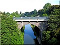
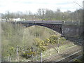
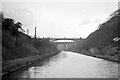
Photos of B70 6DG


Area Information
Living in B70 6DG means being part of a small, densely populated residential cluster in the heart of West Bromwich, a town with a long industrial heritage. The area’s 2060 residents are spread across 1.87 km², creating a compact, tightly knit community. West Bromwich itself lies 8 miles west of Birmingham, with its name distinguishing it from nearby Castle Bromwich. The area’s proximity to major transport routes, including the A41 and rail lines, ensures connectivity to surrounding towns and cities. Daily life here is shaped by its history as a former industrial hub, now transitioning into a more residential focus. The median age of 47 suggests a mature population, with adults aged 30–64 forming the majority. While the area lacks large-scale amenities, its proximity to local shops, schools, and parks offers a practical lifestyle. The low flood risk and absence of protected natural sites make it a stable, low-constraint environment. However, the 27% home ownership rate points to a rental-dominated market, with flats being the primary accommodation type. This dynamic creates a community where renters outnumber homeowners, shaping the local character.
- Area Type
- Postcode
- Area Size
- Not available
- Population
- 2060
- Population Density
- 1107 people/km²
The property market in B70 6DG is characterised by a low home ownership rate of 27%, indicating that the majority of residents are renters rather than homeowners. This suggests a rental-dominated market, with flats being the primary accommodation type. The small area’s limited housing stock means that property options are constrained, and buyers may find competition for available homes. The focus on flats reflects a trend common in densely populated urban areas, where space efficiency is prioritised over larger family homes. For buyers considering the area, the low home ownership rate may signal a transient population, potentially affecting long-term investment value. However, the absence of planning constraints such as protected nature reserves or Areas of Outstanding Natural Beauty offers flexibility for development. Those seeking property here should consider the rental market’s dynamics and the limited availability of owner-occupied homes.
House Prices in B70 6DG
No properties found in this postcode.
Energy Efficiency in B70 6DG
Residents of B70 6DG have access to a range of amenities within practical reach. Five retail locations, including Farmfoods West and Spar, offer essential shopping, while five metro stops like Kenrick Park provide access to parks and local services. The rail network, with stations such as Smethwick Rolfe Street, connects the area to broader transport links. The nearby Kenrick Park, listed as a metro stop, may also function as a green space, offering recreational opportunities. The presence of multiple retail and transport hubs suggests a convenient lifestyle, with daily needs met locally. However, the data does not specify the scale or variety of leisure facilities beyond these points. The area’s compact size means amenities are closely clustered, reducing travel time for residents. This proximity to shops, transport, and parks contributes to a practical, community-focused lifestyle, though larger leisure options may require venturing beyond the immediate postcode.
Amenities
Schools
Residents of B70 6DG have access to two independent schools: Sandwell Valley School, rated outstanding by Ofsted, and V.A.S.E Academy, rated good. Both institutions cater to families seeking private education, though no state schools are listed in the data. The presence of independent schools suggests a focus on private education, which may appeal to households prioritising specific curricula or facilities. However, the absence of state schools means families relying on public education may need to look beyond the immediate area. The Ofsted ratings indicate varying levels of quality, with Sandwell Valley School performing at the highest level. For parents, the mix of school types offers choice but may require additional commuting for state school options. The data does not specify student numbers or catchment areas, so further research would be needed to assess accessibility for specific households.
| Rank | School | Type | Entry gender | Ages |
|---|
Explore more schools in this area
Go to Schools tabDemographics
The population of B70 6DG is 2060, with a density of 1107 people per square kilometre, reflecting a tightly packed residential area. The median age of 47 indicates a mature demographic, with adults aged 30–64 making up the largest age group. Home ownership is low at 27%, suggesting that most residents are renters, which is typical for areas with limited housing stock. The predominant accommodation type is flats, aligning with the small-scale, high-density nature of the postcode. The White ethnic group forms the majority, though specific diversity metrics are not provided. The high population density may contribute to a sense of community but could also impact living space per household. The 27% home ownership rate implies a reliance on rental properties, which may influence local services and amenities. The absence of detailed deprivation data means the area’s quality of life remains unquantified, but the low flood risk and lack of environmental constraints suggest stability.
Household Size
Accommodation Type
Tenure
Ethnic Group
Religion
Household Composition
Age
Household Deprivation
NS-SEC
Explore more demographic insights in this area
Go to Demographics tabPlanning
Planning Constraints
- Flood RiskPremium
- Ramsar Wetland SitesPremium
- Area of Outstanding Natural BeautyPremium
- Protected Nature ReservePremium
- Protected WoodlandPremium