Area Overview for B70 6DE
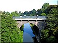
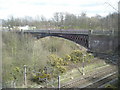
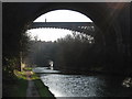
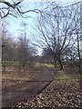
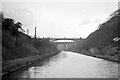
Photos of B70 6DE


Area Information
Living in B70 6DE means being part of a compact residential cluster in West Bromwich, a town with a long industrial heritage in the West Midlands. The area’s population of 2,060 residents, spread across 1.86 km², reflects a densely populated yet tightly knit community. West Bromwich itself is 8 miles west of Birmingham’s city centre, distinguished from Castle Bromwich by its name and historical development. The town’s identity is shaped by its industrial past, including the founding of West Bromwich Albion Football Club in 1878 and the presence of Sandwell District General Hospital. Residents benefit from proximity to major transport routes like the A41 and the Black Country Spine Road, while the area’s small scale means a quieter, more localised feel compared to larger urban centres. The mix of historic and modern infrastructure, from 19th-century roads to contemporary retail hubs like Farmfoods West, creates a practical, no-frills environment for everyday living. For those seeking a balance between accessibility and community, B70 6DE offers a slice of West Bromwich’s character without the congestion of its larger neighbours.
- Area Type
- Postcode
- Area Size
- Not available
- Population
- 2060
- Population Density
- 1107 people/km²
The property market in B70 6DE is characterised by a low home ownership rate of 27%, indicating that the area is largely a rental market. The predominant accommodation type is flats, which suggests a housing stock that is likely older or purpose-built, with limited scope for large family homes. This configuration is typical of small, densely populated postcode areas where space is constrained. For buyers, the limited availability of owner-occupied properties means that opportunities for purchase may be scarce, with a greater emphasis on rental properties. The small size of B70 6DE also means that the immediate surrounding areas may need to be considered for more substantial housing options. The flat-dominated market may appeal to individuals or couples seeking affordable, manageable living spaces, but those prioritising home ownership may find the area less suitable without expanding their search beyond the postcode boundary.
House Prices in B70 6DE
No properties found in this postcode.
Energy Efficiency in B70 6DE
The lifestyle in B70 6DE is shaped by its proximity to a range of practical amenities. Within walking or short driving distance are five metro stops, including Kenrick Park and Trinity Way, offering easy access to public transport. Retail options include Farmfoods West, Heron West, and Spar, providing essentials like groceries and convenience items. Five rail stations, such as Smethwick Rolfe Street and Hawthorns, connect residents to wider networks. Parks and open spaces, though not explicitly named, are implied by the area’s small residential character, suggesting local green spaces for leisure. The presence of multiple retail and transport hubs indicates a community prioritising accessibility and practicality. While the area lacks large-scale entertainment venues, its compact layout ensures that daily needs are met without long commutes. For residents valuing convenience over sprawling amenities, B70 6DE offers a functional, no-nonsense lifestyle with direct access to essential services.
Amenities
Schools
Residents of B70 6DE have access to two independent schools within practical reach: Sandwell Valley School, rated outstanding by Ofsted, and V.A.S.E Academy, rated good. Both institutions cater to independent education, meaning they are privately funded and likely charge tuition fees. The presence of an outstanding-rated school provides a strong option for families prioritising high-quality education, while the good-rated V.A.S.E Academy offers a more affordable alternative. The mix of school types reflects the area’s proximity to West Bromwich’s broader educational infrastructure, though families should consider the financial implications of independent schooling. For those seeking state-funded options, the data does not specify, but the availability of independent schools suggests a community that values private education. Parents evaluating the area should weigh the cost of fees against the quality of provision offered by these institutions.
| Rank | School | Type | Entry gender | Ages |
|---|
Explore more schools in this area
Go to Schools tabDemographics
The demographic profile of B70 6DE is defined by a median age of 47, with the majority of residents aged 30–64. This suggests a mature, stable community with a focus on established households rather than younger families or retirees. Home ownership is low at 27%, indicating that the area is predominantly a rental market. The accommodation type is primarily flats, which aligns with the small, compact nature of the postcode and may reflect older housing stock or purpose-built blocks. The predominant ethnic group is White, with no specific data on other demographics provided. The age range and home ownership figures imply a community where many residents may be renting long-term or living in shared accommodation. The relatively high population density of 1,107 people per km² further underscores the area’s compact, urban character. For prospective buyers, this suggests a market where owner-occupied properties are limited, and rental options may be more prevalent, particularly in flats.
Household Size
Accommodation Type
Tenure
Ethnic Group
Religion
Household Composition
Age
Household Deprivation
NS-SEC
Explore more demographic insights in this area
Go to Demographics tabPlanning
Planning Constraints
- Flood RiskPremium
- Ramsar Wetland SitesPremium
- Area of Outstanding Natural BeautyPremium
- Protected Nature ReservePremium
- Protected WoodlandPremium