Area Overview for B70 6DB
Photos of B70 6DB


Area Information
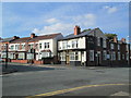
Living in B70 6DB means being part of a compact residential cluster in the West Midlands, nestled within West Bromwich, a town with a long industrial history. The area covers 1.2 hectares and is home to 2060 residents, making it a tightly knit community. West Bromwich itself lies 8 miles west of Birmingham’s city centre, distinguished by its “West” prefix from nearby Castle Bromwich. Daily life here is shaped by its proximity to key transport routes like the A41 and the Black Country Spine Road, which connect to major cities and towns. The area’s small size means residents are close to amenities, schools, and public transport. While the population density is high at 1107 people per square kilometre, the community’s character is defined by its historical roots and modern infrastructure. The ward of West Bromwich Central, which includes B70 6DB, has a population of 15,426 and is represented by three council members. Living here offers a blend of historical context and practical connectivity, though the compact nature of the area means space is limited.
- Area Type
- Postcode
- Area Size
- 1.2 hectares
- Population
- 2060
- Population Density
- 1107 people/km²
The property market in B70 6DB is characterised by a low home ownership rate of 27%, indicating that most residents rent rather than own their homes. The primary accommodation type is flats, which aligns with the area’s small size and high population density. This suggests a housing stock that is likely purpose-built or converted for multi-occupancy, catering to families and individuals seeking affordable living in a connected location. For buyers, the limited availability of owner-occupied properties may mean competition for available homes, particularly if the area is expanding or attracting new residents. The compact nature of the postcode means that property searches should extend beyond B70 6DB itself to nearby wards, where larger housing options or higher ownership rates might be found. The focus on flats also implies that the area is better suited for those prioritising proximity to amenities over space.
House Prices in B70 6DB
No properties found in this postcode.
Energy Efficiency in B70 6DB
Residents of B70 6DB have access to a range of amenities within walking or short driving distance. Retail options include Farmfoods West, Heron West, and Iceland West, providing everyday shopping needs. The area’s proximity to metro stations like Kenrick Park and Trinity Way, along with rail links to Smethwick Galton Bridge High Level and Hawthorns stations, ensures easy access to public transport. Parks and open spaces are not explicitly listed in the data, but the town’s historical infrastructure, such as West Bromwich Ringway, suggests a network of roads that may connect to green spaces. The presence of Sandwell District General Hospital, opened in 1978, adds to the area’s healthcare accessibility. While the immediate vicinity lacks detailed listings of leisure facilities, the broader West Bromwich area is known for its industrial heritage and cultural landmarks, including West Bromwich Albion Football Club. The compact nature of the postcode means that some amenities may be located in nearby wards, requiring a broader search for full convenience.
Amenities
Schools
Residents of B70 6DB have access to two independent schools within practical reach: Sandwell Valley School, which holds an Ofsted rating of “outstanding,” and V.A.S.E Academy, rated “good.” Both institutions cater to a range of educational needs, though the mix of independent schools suggests that families may be prioritising private education over state-run options. The presence of a highly rated school like Sandwell Valley could be a draw for families seeking quality education, while V.A.S.E Academy offers a more accessible alternative. However, the absence of state schools in the data means that the full range of educational options available to residents is not fully detailed. For those requiring state schooling, further research into nearby wards would be necessary, as the immediate area’s focus on independent institutions may not cover all needs.
| Rank | School | Type | Entry gender | Ages |
|---|---|---|---|---|
| 1 | Sandwell Valley School | independent | N/A | N/A |
| 2 | V.A.S.E Academy | independent | N/A | N/A |
Explore more schools in this area
Go to Schools tabDemographics
The population of B70 6DB has a median age of 47, with the majority of residents aged 30–64. This suggests a community of working-age adults, likely with established careers and families. Home ownership is relatively low at 27%, indicating that a significant portion of the housing stock is rented. The predominant accommodation type is flats, reflecting the area’s compact size and likely development as a high-density residential zone. The predominant ethnic group is White, though specific data on diversity is not provided. The age profile and home ownership figures suggest a community that may be more transient than owner-occupied areas, with rental properties dominating. This could influence the local economy and social dynamics, with a focus on affordability over long-term residency. The absence of detailed diversity statistics means the full range of community experiences is not fully captured here.
Household Size
Accommodation Type
Tenure
Ethnic Group
Religion
Household Composition
Age
Household Deprivation
NS-SEC
Explore more demographic insights in this area
Go to Demographics tabPlanning
Planning Constraints
- Flood RiskPremium
- Ramsar Wetland SitesPremium
- Area of Outstanding Natural BeautyPremium
- Protected Nature ReservePremium
- Protected WoodlandPremium
- Crime RiskPremium