Area Overview for B70 0TN
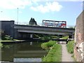
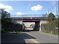
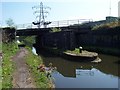
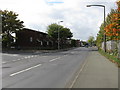
Photos of B70 0TN


Area Information
Living in B70 0TN means being part of a tightly knit residential cluster in the West Midlands, centred around Wednesbury’s historic market town. With a population of 2,094 and a density of 1,673 people per square kilometre, this area balances compact living with a sense of community. Its roots trace back to the 11th century, with medieval trade and industry shaping its character. Today, the postcode area lies within Sandwell borough, a former industrial hub now transitioning into a mix of residential and light commercial use. Residents benefit from proximity to Wednesbury’s historic core, where canals and market traditions still echo. The area’s small size means amenities and services are within walking or cycling distance, though its isolation from major cities requires reliance on public transport. For those seeking a quiet, established neighbourhood with a touch of history, B70 0TN offers a distinct blend of tradition and practicality.
- Area Type
- Postcode
- Area Size
- Not available
- Population
- 2094
- Population Density
- 1673 people/km²
The property market in B70 0TN is defined by a 43% home ownership rate, with houses forming the predominant accommodation type. This suggests a market where larger, family-friendly homes are more common than flats or apartments. The lower home ownership percentage may indicate a higher reliance on rental properties, which could be due to the area’s small size and limited new developments. For buyers, this means competition for existing homes is likely to be moderate, with opportunities to purchase established properties. The focus on houses rather than apartments may appeal to those seeking more space, though the area’s compact nature means land is scarce. Proximity to Wednesbury’s amenities and transport links could enhance the appeal of properties here, particularly for those prioritising convenience over expansive gardens. However, the small postcode area means buyers must consider nearby neighbourhoods for broader options.
House Prices in B70 0TN
No properties found in this postcode.
Energy Efficiency in B70 0TN
The lifestyle in B70 0TN is shaped by its proximity to retail, transport, and community hubs. Residents have access to five retail venues, including Co-op Hill and Asda Great, offering everyday shopping needs. Metro stations like Wednesbury Great Western Street and Black Lake provide links to local services, while rail stations such as Sandwell & Dudley offer regional connectivity. Though the area lacks major leisure facilities, its compact nature ensures amenities are within walking distance. The presence of multiple railway stations suggests a commuter-friendly environment, though the absence of large parks or recreational spaces may require trips to nearby towns. For those valuing convenience over expansive green spaces, B70 0TN’s layout supports a practical, low-maintenance lifestyle. The mix of retail and transport options caters to daily needs, though its character is more utilitarian than leisure-focused.
Amenities
Schools
Residents of B70 0TN have access to three primary schools within the area: Harvills Hawthorn Infant and Nursery School, Harvills Hawthorn Junior School, and Harvills Hawthorn Primary School, which holds an outstanding Ofsted rating. This combination of nursery, junior, and primary education ensures a seamless transition for children from early years through to Key Stage 2. The presence of an outstanding-rated school is a significant draw for families, offering assurance of high-quality teaching and facilities. The clustering of schools in the area reduces the need for long commutes, supporting a lifestyle where parents can balance work and family commitments. For those prioritising education, this mix of school types provides flexibility, whether seeking early years care or a primary school with strong academic outcomes.
| Rank | School | Type | Entry gender | Ages |
|---|
Explore more schools in this area
Go to Schools tabDemographics
The community in B70 0TN is predominantly composed of adults aged 30–64, with a median age of 47. This suggests a mature population, likely with established careers and family structures. Home ownership sits at 43%, indicating a mix of owner-occupied properties and rental housing. The area is characterised by houses rather than flats, reflecting a preference for larger, more private living spaces. The predominant ethnic group is White, though no specific data on diversity or deprivation is provided. The age profile implies a stable, long-term resident base, which can foster a sense of continuity. However, the relatively low home ownership rate may suggest a higher proportion of renters, potentially influencing local dynamics. For buyers, this demographic profile indicates a market skewed towards family homes, with potential for long-term value retention in a low-turnover area.
Household Size
Accommodation Type
Tenure
Ethnic Group
Religion
Household Composition
Age
Household Deprivation
NS-SEC
Explore more demographic insights in this area
Go to Demographics tabPlanning
Planning Constraints
- Flood RiskPremium
- Ramsar Wetland SitesPremium
- Area of Outstanding Natural BeautyPremium
- Protected Nature ReservePremium
- Protected WoodlandPremium