Area Overview for B70 0SW
Photos of B70 0SW


Area Information
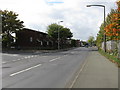
Living in B70 0SW means being part of a tightly knit residential cluster in the historic market town of Wednesbury, part of Sandwell in the West Midlands. With a population of 2,094 and a density of 1,673 people per square kilometre, this area is compact yet rich in historical character. Centred around coordinates 52.53184, -2.02456, it sits within the Wednesbury South Ward, a district shaped by medieval roots and 18th-century industrial growth. The area retains echoes of its past as a rural community and nail-making hub, now balanced with modern amenities. Daily life here is defined by proximity to local services, a mix of older and newer housing, and a community skewed towards adults aged 30–64. While the postcode area is small, its strategic location near B70 0DY and Wednesbury offers access to broader regional networks. Residents benefit from a blend of traditional charm and practical infrastructure, making it appealing to those seeking a stable, community-focused environment without sacrificing connectivity.
- Area Type
- Postcode
- Area Size
- Not available
- Population
- 2094
- Population Density
- 1673 people/km²
The property market in B70 0SW is characterised by a 43% home ownership rate, indicating that more than half of properties are rented. This suggests a rental market that may cater to professionals or families seeking flexibility, though the exact balance between owner-occupied and rental properties is not quantified. The accommodation type is primarily houses, which aligns with the area’s residential focus and could appeal to those prioritising space and privacy. As a small postcode area, the housing stock is limited, meaning buyers may need to look beyond B70 0SW itself to find options. The prevalence of houses may also reflect a preference for traditional, family-friendly homes, though the lack of specific data on property prices or development trends means the market’s dynamics remain opaque. For buyers, this could mean competition for available properties and the need to consider nearby areas for broader choices.
House Prices in B70 0SW
No properties found in this postcode.
Energy Efficiency in B70 0SW
The lifestyle in B70 0SW is supported by a range of nearby amenities, including five retail venues such as Co-op Hill and Asda Great, offering everyday shopping needs. The area’s proximity to metro and rail stations like Wednesbury Great Western Street and Tipton Railway Station ensures easy access to public transport for commuting or leisure. While specific parks or leisure facilities are not detailed in the data, the presence of multiple retail and transport hubs suggests a convenient, community-oriented environment. Residents can enjoy a mix of practical services and connectivity, making daily errands and travel efficient. The character of the area is shaped by its compact size and historical roots, blending traditional charm with modern necessities. This balance of accessibility and local identity contributes to a lifestyle that prioritises convenience without sacrificing a sense of place.
Amenities
Schools
Residents of B70 0SW have access to three primary schools within practical reach: Harvills Hawthorn Infant and Nursery School, Harvills Hawthorn Junior School, and Harvills Hawthorn Primary School, which holds an outstanding Ofsted rating. This concentration of primary education options provides families with a seamless transition from nursery through to primary years, reducing the need for long commutes. The presence of an outstanding-rated school adds value for parents prioritising academic standards, while the mix of infant, junior, and combined schools ensures coverage for all early education stages. These institutions are likely central to the area’s community life, offering not only education but also extracurricular activities and parental networks. For families, the proximity of these schools is a significant advantage, reinforcing B70 0SW’s appeal as a place to raise children.
| Rank | School | Type | Entry gender | Ages |
|---|
Explore more schools in this area
Go to Schools tabDemographics
The community in B70 0SW is predominantly composed of adults aged 30–64, with a median age of 47. This suggests a mature population, likely with established careers and family ties. Home ownership rates stand at 43%, indicating a mix of owner-occupied and rented properties. The accommodation type is primarily houses, reflecting a residential profile suited to families or individuals seeking more space. The predominant ethnic group is White, though no specific data on diversity beyond this is provided. The population density of 1,673 people per square kilometre implies a tightly packed area, which may influence the pace of life and availability of communal spaces. While no deprivation data is explicitly stated, the age profile and housing stock suggest a stable, working-age population with a focus on long-term residency rather than transient demographics.
Household Size
Accommodation Type
Tenure
Ethnic Group
Religion
Household Composition
Age
Household Deprivation
NS-SEC
Explore more demographic insights in this area
Go to Demographics tabPlanning
Planning Constraints
- Flood RiskPremium
- Ramsar Wetland SitesPremium
- Area of Outstanding Natural BeautyPremium
- Protected Nature ReservePremium
- Protected WoodlandPremium