Area Overview for B70 0SA
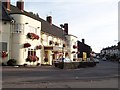
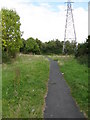
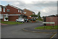
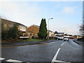
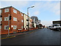
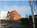
Photos of B70 0SA
Area Information
B70 0SA is a small residential postcode area in England, centred around Wednesbury in the West Midlands. With a population of 1,677, it reflects the character of a compact, historically rooted community. The area’s demographics suggest a mature population, with a median age of 47 and most residents falling into the 30-64 age bracket. This suggests a stable, established community with a focus on family life and long-term residency. The area’s proximity to Wednesbury, a historic market town with roots dating back to the 11th century, offers a blend of local heritage and modern convenience. While the postcode covers a small cluster of homes, it benefits from nearby amenities such as retail stores, transport links, and educational facilities. The presence of 59% home ownership and a predominance of houses indicates a mix of private residences and possibly some rental properties. For buyers, B70 0SA represents a quiet, low-density living environment with accessible services and a distinct regional identity.
- Area Type
- Postcode
- Area Size
- Not available
- Population
- 1677
- Population Density
- 5571 people/km²
The property market in B70 0SA is characterised by a 59% home ownership rate, indicating that most properties are owner-occupied rather than rented. The accommodation type is predominantly houses, which may suggest a preference for larger, standalone homes over flats or apartments. This could appeal to families or individuals seeking more space, though the small size of the area may limit the availability of new builds or developments. The relatively high proportion of owner-occupied homes implies a stable market with fewer rental properties, which could be a consideration for buyers looking for investment opportunities or rental income. Given the area’s compact nature, property values may be influenced by proximity to local amenities such as schools, transport links, and retail outlets. Buyers should also consider the potential for limited growth in the housing stock, as the area is described as a small residential cluster.
House Prices in B70 0SA
No properties found in this postcode.
Energy Efficiency in B70 0SA
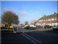
Residents of B70 0SA have access to a range of nearby amenities, including five retail outlets such as Co-op Hill, Aldi Tildasley, and Asda Great, which cater to everyday shopping needs. The area’s transport links also connect to leisure and recreational spaces, though specific parks or recreational facilities are not listed in the data. The presence of multiple rail and metro stops, such as Wednesbury Great Western Street and Dudley Street Guns Village, suggests ease of access to urban centres for dining, entertainment, or cultural activities. While the data does not specify restaurants or cafes, the proximity to transport hubs implies a variety of options in nearby towns. The combination of retail, transport, and connectivity creates a convenient lifestyle, allowing residents to balance local convenience with broader opportunities. The small-scale nature of the area may foster a close-knit community, with amenities tailored to daily living rather than large-scale commercial developments.
Amenities
Schools
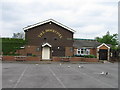
The nearest school to B70 0SA is Hill Top High School, which is a primary school. No Ofsted rating is provided in the data, so its performance cannot be assessed directly. The presence of a primary school suggests that the area may cater to families with young children, though the absence of secondary schools or additional educational institutions means parents may need to look further afield for comprehensive schooling. The single listed school indicates a limited range of educational options, which could be a factor for families prioritising proximity to schools. Without further data on school catchment areas or student numbers, it is unclear how well the school serves the local population. Prospective buyers with children should investigate additional educational resources in the broader Wednesbury area.
| Rank | School | Type | Entry gender | Ages |
|---|
Explore more schools in this area
Go to Schools tabDemographics
The population of B70 0SA is 1,677, with a median age of 47. This suggests a community skewed towards middle-aged adults, with the 30-64 age range being the most common. Home ownership stands at 59%, meaning nearly six in ten residents own their homes, while the remaining 41% likely rent. The area is predominantly composed of houses, which may indicate a preference for larger properties over flats or apartments. The predominant ethnic group is Asian_total, reflecting a culturally diverse demographic. This diversity may influence local traditions and community dynamics. The absence of specific deprivation data means the quality of life cannot be fully assessed, but the age profile and home ownership rate suggest a relatively stable, settled population. The mix of ages and household types could support a range of local services, from schools to healthcare, though the exact needs of the community are not detailed in the data.
Household Size
Accommodation Type
Tenure
Ethnic Group
Religion
Household Composition
Age
Household Deprivation
NS-SEC
Explore more demographic insights in this area
Go to Demographics tabPlanning
Planning Constraints
- Flood RiskPremium
- Ramsar Wetland SitesPremium
- Area of Outstanding Natural BeautyPremium
- Protected Nature ReservePremium
- Protected WoodlandPremium