Area Overview for B70 0QY
Photos of B70 0QY
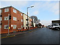
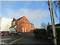
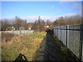
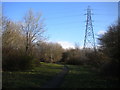
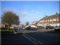
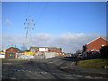
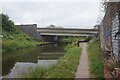
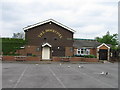
27 photos from this area
Area Information
Key information about the B70 0QY including its size, population, and administrative classification.
- Area Type
- Postcode
- Area Size
- 4622 m²
- Population
- 2033
- Population Density
- 2236 people/km²
House Prices in B70 0QY
14
Properties
£137,439
Average Sold Price
£90,000
Lowest Price
£194,000
Highest Price
Showing 14 properties
| Address | Type | Beds | Baths | Last Sale Price | Last Sale Date | |
|---|---|---|---|---|---|---|
| 13 Lee Street, West Bromwich, B70 0QY | Terraced | 3 | - | £164,000 | Jun 2025 | |
| 17 Lee Street, West Bromwich, B70 0QY | Bungalow | 3 | 1 | £194,000 | Aug 2022 | |
| 19 Lee Street, West Bromwich, B70 0QY | house | - | - | £140,000 | Nov 2015 | |
| 22 Lee Street, West Bromwich, B70 0QY | Detached | 5 | 1 | £125,000 | Apr 2012 | |
| 14 Lee Street, West Bromwich, B70 0QY | Semi-detached | - | - | £104,000 | Jan 2009 | |
| 15 Lee Street, West Bromwich, B70 0QY | Detached | - | - | £170,000 | Dec 2007 | |
| 11 Lee Street, West Bromwich, B70 0QY | house | - | - | £120,000 | Jul 2007 | |
| 24 Lee Street, West Bromwich, B70 0QY | Semi-detached | - | - | £129,950 | Jun 2005 | |
| 16 Lee Street, West Bromwich, B70 0QY | house | 3 | 1 | £90,000 | Jul 2003 | |
| 20 Lee Street, West Bromwich, B70 0QY | Terraced | - | - | - | - |
Page 1 of 2
Energy Efficiency in B70 0QY
Amenities
Schools
| Rank | School | Type | Entry gender | Ages |
|---|
Explore more schools in this area
Go to Schools tabDemographics
Household Size
Family (3-5 people)
most common
Accommodation Type
Houses
most common
Tenure
64
majority
Ethnic Group
asian_total
most common
Religion
N/A
most common
Household Composition
N/A
most common
Age
47
median
Adults (30-64 years)
most common
Household Deprivation
N/A
with no deprivation
NS-SEC
19
in Lower managerial occupations
Explore more demographic insights in this area
Go to Demographics tabPlanning
Planning Constraints
- Flood RiskPremium
- Ramsar Wetland SitesPremium
- Area of Outstanding Natural BeautyPremium
- Protected Nature ReservePremium
- Protected WoodlandPremium