Area Overview for B70 0NJ
Photos of B70 0NJ
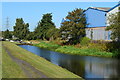
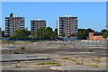

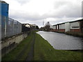
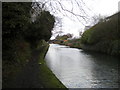
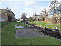
32 photos from this area
Area Information
Key information about the B70 0NJ including its size, population, and administrative classification.
- Area Type
- Postcode
- Area Size
- 9928 m²
- Population
- 2094
- Population Density
- 1673 people/km²
House Prices in B70 0NJ
27
Properties
£98,188
Average Sold Price
£34,000
Lowest Price
£195,000
Highest Price
Showing 27 properties
| Address | Type | Beds | Baths | Last Sale Price | Last Sale Date | |
|---|---|---|---|---|---|---|
| 68 Anson Road, West Bromwich, B70 0NJ | Terraced | 3 | - | £195,000 | Apr 2022 | |
| 80 Anson Road, West Bromwich, B70 0NJ | Semi-detached | 3 | 1 | £81,000 | May 2015 | |
| 64 Anson Road, West Bromwich, B70 0NJ | Terraced | 3 | - | £104,000 | Aug 2013 | |
| 66 Anson Road, West Bromwich, B70 0NJ | house | - | - | £102,500 | May 2007 | |
| 60 Anson Road, West Bromwich, B70 0NJ | Semi-detached | - | - | £90,000 | Aug 2006 | |
| 54 Anson Road, West Bromwich, B70 0NJ | Semi-detached | - | - | £95,000 | Mar 2006 | |
| 62 Anson Road, West Bromwich, B70 0NJ | Semi-detached | - | - | £84,000 | Nov 2004 | |
| 129 Anson Road, West Bromwich, B70 0NJ | house | - | - | £34,000 | Apr 2001 | |
| 76 Anson Road, West Bromwich, B70 0NJ | house | - | - | - | - | |
| 139 Anson Road, West Bromwich, B70 0NJ | house | - | - | - | - |
Page 1 of 3
Energy Efficiency in B70 0NJ
Amenities
Schools
| Rank | School | Type | Entry gender | Ages |
|---|
Explore more schools in this area
Go to Schools tabDemographics
Household Size
Family (3-5 people)
most common
Accommodation Type
Houses
most common
Tenure
43
majority
Ethnic Group
White
most common
Religion
N/A
most common
Household Composition
N/A
most common
Age
47
median
Adults (30-64 years)
most common
Household Deprivation
N/A
with no deprivation
NS-SEC
14
in Lower managerial occupations
Explore more demographic insights in this area
Go to Demographics tabPlanning
Planning Constraints
- Flood RiskPremium
- Ramsar Wetland SitesPremium
- Area of Outstanding Natural BeautyPremium
- Protected Nature ReservePremium
- Protected WoodlandPremium