Area Overview for B70 0ED
Photos of B70 0ED
Area Information
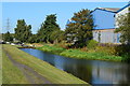
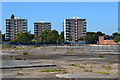
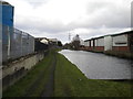
Living in B70 0ED means being part of a small, tightly knit residential cluster in the heart of Wednesbury, a historic market town in Sandwell, West Midlands. With a population of 2,068 and a high density of 1,483 people per square kilometre, this area is compact yet functional, centred around the coordinates 52.53184, -2.02456. The community reflects its heritage as a former industrial hub, with a median age of 47 and a population skewed toward adults aged 30–64. Most residents own their homes, with 51% of properties in private ownership, and the area is dominated by houses rather than flats. Daily life here is shaped by its proximity to local amenities, historic sites, and transport links. While the area lacks large-scale commercial developments, its small size fosters a sense of familiarity. For those seeking a quiet, established community with a touch of history, B70 0ED offers a blend of practicality and character.
- Area Type
- Postcode
- Area Size
- Not available
- Population
- 2068
- Population Density
- 1483 people/km²
The property market in B70 0ED is characterised by a strong presence of owner-occupied homes, with 51% of properties in private hands. The area is predominantly composed of houses, not flats, which may appeal to families seeking space and privacy. Given the small size of the postcode area, the housing stock is limited, and the market is likely to be competitive for buyers. The high proportion of owner-occupied properties suggests a stable, long-term resident base, which can be a positive indicator for property retention. However, the lack of data on rental availability or property types beyond houses means the market’s balance between owner-occupied and rental properties remains unclear. For those considering purchase, the focus on houses may align with preferences for larger living spaces, though the area’s compact nature means proximity to amenities is a key selling point.
House Prices in B70 0ED
No properties found in this postcode.
Energy Efficiency in B70 0ED
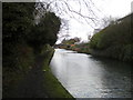
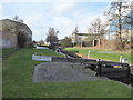
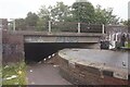
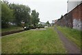
Life in B70 0ED is shaped by its proximity to a mix of retail, transport, and leisure facilities. The area has five notable retail venues, including Asda Great, Heron Tipton, and Co-op Hill, providing access to groceries, clothing, and general goods. Metro stops like Black Lake and Dudley Street Guns Village connect residents to wider networks, while rail stations such as Dudley Port and Tipton offer direct links to Birmingham and beyond. The presence of multiple transport options enhances mobility, whether for commuting or weekend trips. Though the area is small, the density of amenities ensures convenience for daily needs. The character of the community is further enriched by its historic roots, with nearby sites reflecting Wednesbury’s industrial past. This blend of practicality and heritage creates a functional, accessible lifestyle for residents.
Amenities
Schools
The nearest school to B70 0ED is Newtown Primary School, which serves the local community with a primary education offering. The school has an Ofsted rating of ‘good’, indicating it meets standards in teaching quality and student outcomes. As the only named school in the area, it is the primary option for young children, though families may need to look beyond the postcode for secondary education. The presence of a ‘good’-rated primary school is a significant advantage for parents prioritising quality education, though the limited range of school types suggests a focus on early years learning. For those considering B70 0ED, the availability of a well-regarded primary school is a key factor in assessing the area’s suitability for families.
| Rank | School | Type | Entry gender | Ages |
|---|
Explore more schools in this area
Go to Schools tabDemographics
The demographic profile of B70 0ED is defined by its mature population, with a median age of 47 and the majority of residents falling within the 30–64 age range. This suggests a community of established professionals and families, rather than a younger, transient population. Home ownership is strong, with 51% of households owning their homes, while the remaining 49% are likely renters. The area is predominantly occupied by houses, not flats, which aligns with the demographic preference for family-friendly housing. The predominant ethnic group is White, reflecting the broader regional composition. The high population density—1,483 people per square kilometre—suggests a compact, efficient use of space, though the small area size means resources are shared closely. For buyers, this indicates a stable, low-turnover market where properties are likely to remain in private hands for extended periods.
Household Size
Accommodation Type
Tenure
Ethnic Group
Religion
Household Composition
Age
Household Deprivation
NS-SEC
Explore more demographic insights in this area
Go to Demographics tabPlanning
Planning Constraints
- Flood RiskPremium
- Ramsar Wetland SitesPremium
- Area of Outstanding Natural BeautyPremium
- Protected Nature ReservePremium
- Protected WoodlandPremium