Area Overview for B70 0DS
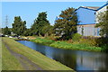
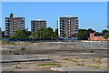
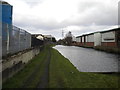
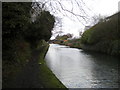
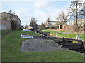
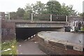
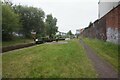
Photos of B70 0DS

Area Information
The postcode B70 0DS covers a compact residential cluster of only 3878 square metres. Despite its small physical footprint, the area houses a population of 2094 people, creating a significant density of 1673 people per square kilometre. This specific postcode area centres on Wednesbury South Ward, which sits within the Sandwell borough in the West Midlands. Locally, the ward historically anchors the historic market town of Wednesbury, sitting near WS10 and the wider B70 area. The location represents an established urban district that has evolved from ancient origins first mentioned in 1004. The site sits on land that once supported coal mining and nail-making industries before receiving a market charter in 1709. Even today, the area retains a connection to its industrial past, but residents primarily navigate modern suburban streets. The high density within these few square kilometres suggests a tightly packed neighbourhood where properties sit close together. You are accessing a space defined by its history and its current role as a dense residential pocket in a larger market town.
- Area Type
- Postcode
- Area Size
- 3878 m²
- Population
- 2094
- Population Density
- 1673 people/km²
The property market for B70 0DS is characterised by historic stock and a mixed tenure split. Houses dominate the landscape, serving as the primary accommodation type for the 2094 residents living within the 3878 square metre zone. Half of the housing stock falls into the rental category, while 43 per cent of properties are owner-occupied. This suggests a balance between investors and families seeking stability in the area. The small physical size of the postcode boundary often implies that the immediate surroundings may contain similar property types. Buyers looking at homes in this area are purchasing established dwellings rather than new builds. The market here is not driven by luxury or recent development, but by the availability of traditional housing within a specific urban ward. If you are browsing listings, assume you will see terraced or semi-detached homes typical of the Wednesbury South Ward. The density of 1673 people per square kilometre confirms that space is limited, which can influence both property prices and future development potential in the broader Sandwell borough.
House Prices in B70 0DS
No properties found in this postcode.
Energy Efficiency in B70 0DS
Living in B70 0DS offers immediate access to key retail and leisure facilities within practical reach. Residents can shop at Asda Great, Heron Tipton, and Lidl Tipton, covering weekly grocery needs. The area provides five notable retail outlets, ensuring practical shopping is never far away. For leisure and social activities, five metro-style destinations are nearby, including Black Lake and Dudley Street Guns Village. Local families can enjoy outdoor spaces at these venues without needing a long drive. Transport links are equally accessible, with five railway stations within easy reach. You can travel from Dudley Port Railway Station, Tipton Railway Station, or Sandwell & Dudley Railway Station to access wider regional connections. This network of five rail hubs allows easy commuting. The proximity to Black Lake adds a specific green space option for local recreation. Your daily lifestyle will be shaped by these nearby amenities, which cluster closely around the housing estate.
Amenities
Schools
Families moving to B70 0DS have several excellent educational options within practical reach. All three named schools in the immediate vicinity are primary institutions. Children can enrol at Harvills Hawthorn Nursery School, which serves the earliest years of education. The area also includes Harvills Hawthorn Infant School for young children. For primary-aged pupils, the notable choice is Harvills Hawthorn Junior School, which currently holds an outstanding Ofsted rating. The presence of an outstanding-rated school nearby is a significant asset for parents in the postcode. This concentration of primary education means you do not need to travel far to secure a quality schooling place for a young child. The mix of infant and junior facilities under the Harvills Hawthorn brand indicates a coordinated local provision. You can expect the area to support children from their youngest years through to the early secondary compulsory years without leaving the local community.
| Rank | School | Type | Entry gender | Ages |
|---|
Explore more schools in this area
Go to Schools tabDemographics
The community profile for B70 0DS shows a mature population with a median age of 47 years. The most common age range consists of adults between 30 and 64 years old. This demographic skew indicates the area attracts families and established professionals rather than young students or retirees. Regarding housing, 43 per cent of homes in this postcode are owner-occupied, meaning the other 57 per cent are rented or shared. Houses remain the predominant accommodation type, reflecting a traditional suburban street pattern rather than blocks of flats. The area identifies White as the predominant ethnic group, which aligns with the broader historical settlement patterns of the West Midlands. While the area is not the most diverse in the country, the mix supports a stable, long-term resident base. You should expect a neighbourhood where neighbours are likely to have been living nearby for many years. The high density and specific age profile create a quiet but socially active environment where daily routines overlap with established community norms.
Household Size
Accommodation Type
Tenure
Ethnic Group
Religion
Household Composition
Age
Household Deprivation
NS-SEC
Explore more demographic insights in this area
Go to Demographics tabPlanning
Planning Constraints
- Flood RiskPremium
- Ramsar Wetland SitesPremium
- Area of Outstanding Natural BeautyPremium
- Protected Nature ReservePremium
- Protected WoodlandPremium