Area Overview for B70 0AH
Photos of B70 0AH


Area Information
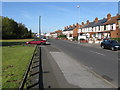
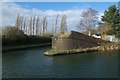
Living in B70 0AH means inhabiting a compact, densely populated residential cluster in the heart of West Bromwich, part of the Greets Green and Lyng Ward area. The postcode covers just 3.8 hectares, yet it houses 1,522 people, translating to a population density of 40,502 per square kilometre. This small area blends interwar and post-war housing, with some pre-First World War buildings, reflecting its history as a working-class community. The area’s character is shaped by its proximity to the Walsall Canal and the legacy of the Black Country’s industrial past, though recent regeneration efforts have introduced mixed-tenure developments. B70 0AH retains a strong sense of local identity, with community-led initiatives like the Lyng Community Association influencing its modern landscape. Residents benefit from proximity to rail networks, retail hubs, and schools, while the area’s compact size means amenities are within easy reach. Its appeal lies in a balance of historical depth, practical connectivity, and ongoing redevelopment aimed at improving living standards.
- Area Type
- Postcode
- Area Size
- 3.8 hectares
- Population
- 1522
- Population Density
- 4628 people/km²
The property market in B70 0AH is defined by a 45% home ownership rate, suggesting that less than half of properties are owner-occupied, with the remainder likely in the rental sector. The accommodation type is predominantly houses, which is unusual for a small, densely packed postcode. This mix of housing stock—combining older interwar and post-war homes with newer developments—creates a varied market. The limited area size means the housing stock is finite, potentially leading to competition among buyers. For those seeking homes, the focus is on family-sized properties, given the median age of residents and the presence of schools. However, the prevalence of council housing and ongoing demolitions may affect availability and pricing. Buyers should consider the compact nature of the area and the need for proximity to amenities when evaluating properties.
House Prices in B70 0AH
No properties found in this postcode.
Energy Efficiency in B70 0AH
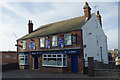
Daily life in B70 0AH is shaped by its proximity to a variety of amenities. Residents can access five metro stops, including Dudley Street Guns Village and Black Lake, offering transport links and local hubs. Retail options include Asda Great, Aldi Tildasley, and Heron Tipton, providing everyday shopping convenience. The area’s rail network connects to major stations, facilitating travel to Birmingham and beyond. Nearby, Marl Hole Park offers green space for recreation, while the Walsall Canal adds a scenic element. The mix of retail, transport, and open space supports a balanced lifestyle, with community events likely centred around local venues. The compact nature of the area means amenities are within easy reach, enhancing the practicality of daily living.
Amenities
Schools
Residents of B70 0AH have access to a range of educational institutions, including George Collegiate Academy, a primary school, and Glenvale School, which specialises in supporting students with specific needs. George Salter Academy, an academy with a good Ofsted rating, provides secondary education. This mix of school types ensures families can choose between primary, special needs, and secondary education within the area. The presence of a good-rated academy suggests higher standards in secondary education, while the special school caters to diverse learning requirements. The proximity of these schools to homes in B70 0AH makes the area appealing to families prioritising accessible education. The combination of school types also reflects the community’s commitment to inclusive and varied educational provision.
| Rank | School | Type | Entry gender | Ages |
|---|
Explore more schools in this area
Go to Schools tabDemographics
The population of B70 0AH has a median age of 47, with the majority of residents aged 30–64. This suggests a community skewed towards middle-aged adults, likely including families and professionals. Home ownership stands at 45%, indicating a mix of owner-occupied and rental properties, with houses being the predominant accommodation type. The Asian_total group forms the largest ethnic cohort, reflecting the area’s demographic makeup. Despite the presence of council housing and ongoing demolitions of older properties, the area retains a working-class character, though deprivation is evident in certain pockets. This demographic profile implies a stable, family-oriented environment, with a focus on long-term residency rather than transient populations. The age range also suggests a demand for schools and community services, which are well represented in the area.
Household Size
Accommodation Type
Tenure
Ethnic Group
Religion
Household Composition
Age
Household Deprivation
NS-SEC
Explore more demographic insights in this area
Go to Demographics tabPlanning
Planning Constraints
- Flood RiskPremium
- Ramsar Wetland SitesPremium
- Area of Outstanding Natural BeautyPremium
- Protected Nature ReservePremium
- Protected WoodlandPremium