Area Overview for B7 5RE
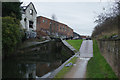
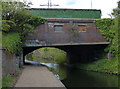
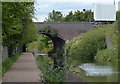
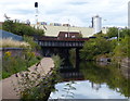
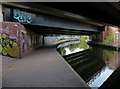
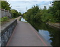
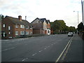
Photos of B7 5RE
Area Information
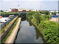
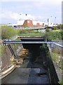
B7 5RE is a small residential postcode in central Birmingham, part of the Nechells district, covering just 4.3 hectares. With a population of 1,951, it is densely populated, reflecting the area’s compact nature. The postcode sits within a historically industrialised part of Birmingham, shaped by post-war redevelopment that replaced slums with low-rise housing. Nechells itself is a ward with a layered history, including 19th-century churches, 20th-century high-rise flats, and a legacy of working-class communities. Living here means proximity to Birmingham’s city centre, with easy access to transport links and a mix of retail and leisure options. The area’s character is defined by its industrial past and recent regeneration, offering a blend of affordability and practicality. While the population density is high, the small size of B7 5RE means residents share a tight-knit environment, with amenities and services within walking or short transit distance. For buyers, this area balances historical significance with modern necessities, though its compact footprint means housing choices are limited to a small cluster of properties.
- Area Type
- Postcode
- Area Size
- 4.3 hectares
- Population
- 1951
- Population Density
- 2213 people/km²
B7 5RE’s property market is characterised by a low home ownership rate (35%) and a predominance of houses. Given the area’s small size (4.3 hectares) and high population density (45,883 people per km²), the housing stock is likely limited to a small number of terraced or semi-detached homes. The low home ownership rate suggests that the area functions more as a rental market than an owner-occupied one, with many residents renting from private landlords or housing associations. This dynamic may make it challenging for buyers seeking long-term investment, as competition for available properties is likely high. The compact nature of the postcode means that property prices and availability are tightly tied to the immediate surrounding area, with limited scope for expansion. For buyers, this area may appeal to those prioritising affordability and proximity to Birmingham’s city centre over larger living spaces. However, the small footprint and high density also mean that property choices are constrained, requiring careful consideration of location and local amenities.
House Prices in B7 5RE
No properties found in this postcode.
Energy Efficiency in B7 5RE
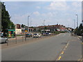
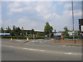
Life in B7 5RE is shaped by its proximity to retail, transport, and historical sites. Within walking distance are major retail outlets like Costco Birmingham, Co-op Birmingham, and Asda Armada, offering a range of shopping and dining options. The nearby metro stops at Bull Street, St Chads, and Corporation Street provide easy access to Birmingham’s city centre, where more extensive leisure and cultural facilities are available. Historically, the area is linked to Nechells Baths, a Grade II listed building, and Wing Yip, a notable Chinese food superstore and business hub. While the area lacks large parks or green spaces, its compact nature ensures that essential amenities are within reach. The presence of churches such as St Clement’s and St Joseph’s, along with the legacy of industrial sites like the former Nechells gasworks, adds to the area’s character. However, the high population density and limited housing stock mean that public spaces are shared among residents. For those prioritising convenience over expansive recreational areas, B7 5RE offers a practical, albeit compact, lifestyle with access to daily necessities and transport links.
Amenities
Schools
B7 5RE is served by several schools, including St Clement’s Church of England Primary School and St Joseph’s Catholic Primary School, both offering primary education. Additionally, St Clement’s Church of England Academy, an academy with a ‘good’ Ofsted rating, provides secondary education for the area. The presence of two primary schools and one academy offers families a range of educational options, though the limited number of institutions may mean competition for places, particularly at the secondary level. The academy’s ‘good’ rating suggests a standard of education that meets regulatory benchmarks, though it does not indicate exceptional performance. The proximity of these schools to the area ensures that children can attend local institutions without long commutes. However, the lack of diversity in school types—no independent or specialist schools are listed—may limit choices for parents seeking specific curricula or facilities. Overall, the school infrastructure supports basic educational needs but may not cater to niche requirements.
| Rank | School | Type | Entry gender | Ages |
|---|
Explore more schools in this area
Go to Schools tabDemographics
The median age in B7 5RE is 47, with the majority of residents falling between 30 and 64 years old. This suggests a community dominated by working-age adults, many of whom may be in their prime earning years. Home ownership rates are relatively low at 35%, indicating that a significant portion of the population rents their homes. The predominant accommodation type is houses, though the small area size and high population density suggest these are likely terraced or semi-detached properties. The predominant ethnic group is Black residents, reflecting the area’s historical ties to post-war immigration from the Caribbean and Indian sub-continent. This demographic profile implies a community with established cultural networks but also potential challenges in accessing services tailored to specific needs. The 35% home ownership rate may also reflect economic pressures, with many residents relying on rental markets or shared housing. The age range and population density suggest a stable but mature community, with limited presence of younger families or retirees.
Household Size
Accommodation Type
Tenure
Ethnic Group
Religion
Household Composition
Age
Household Deprivation
NS-SEC
Explore more demographic insights in this area
Go to Demographics tabPlanning
Planning Constraints
- Flood RiskPremium
- Ramsar Wetland SitesPremium
- Area of Outstanding Natural BeautyPremium
- Protected Nature ReservePremium
- Protected WoodlandPremium