Area Overview for B7 5JW
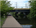
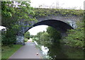
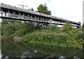
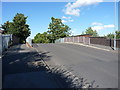
Photos of B7 5JW

Area Information
Living in B7 5JW means inhabiting a small, defined postcode area within central Birmingham’s Nechells district. With a population of 1,784, this cluster is part of a broader urban landscape shaped by post-war redevelopment and industrial history. Nechells itself is a ward with a layered past, including 19th-century railway workshops and 20th-century high-rise flats replaced by low-rise housing. The area’s character is defined by its working-class roots, with a mix of residential properties and historic sites like Nechells Baths. Residents here are predominantly adults aged 30–64, reflecting a community with established ties to the area. Daily life is influenced by proximity to rail networks, retail hubs, and schools, though the postcode’s small size means it is a microcosm of broader Birmingham dynamics. The area’s accessibility to multiple railway stations and metro stops ensures connectivity, while its proximity to amenities like Costco and Asda supports practical living. However, the community faces challenges, including higher-than-average crime rates, which require attention. For those seeking a compact, urban lifestyle with historical depth, B7 5JW offers a distinct, if complex, proposition.
- Area Type
- Postcode
- Area Size
- Not available
- Population
- 1784
- Population Density
- 1927 people/km²
The property market in B7 5JW is defined by a low home ownership rate (23%) and a predominance of houses over flats. This suggests a rental-dominated market, with limited owner-occupied properties. The presence of houses, rather than high-density housing, may indicate a focus on family homes or larger units, though the small postcode area means the housing stock is likely limited in scale. For buyers, this presents challenges: the area’s compact size and low home ownership suggest limited availability of properties for purchase, and the rental market may be competitive. The mix of houses and the lack of high-rise development also imply a more traditional, low-rise urban fabric. However, the area’s proximity to transport links and amenities could make it attractive for those prioritising convenience over property investment. Buyers should consider the limited scope for growth in the housing market here, as well as the broader context of Birmingham’s property trends.
House Prices in B7 5JW
No properties found in this postcode.
Energy Efficiency in B7 5JW
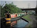
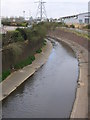
The lifestyle in B7 5JW is shaped by its proximity to retail, transport, and community hubs. Nearby amenities include major supermarkets like Costco Birmingham and Tesco Aston, offering convenience for daily shopping. The area’s rail and metro stations, such as Aston Railway Station and St Paul’s, provide easy access to Birmingham’s transport network, supporting both commuting and leisure travel. For dining, the presence of Wing Yip Chinese food superstore at Nechells Green adds cultural variety to the local food scene. Historic sites like Nechells Baths and listed buildings such as the Presbyterian chapel on Long Acre contribute to the area’s character, blending practicality with heritage. The working-class atmosphere, rooted in industrial history, influences the community’s identity. While the area lacks large parks or green spaces in the data, its compact size ensures that amenities are within practical reach, fostering a sense of convenience for residents. This mix of retail, transport, and historical elements defines a lifestyle that prioritises accessibility and local identity.
Amenities
Schools
Residents of B7 5JW have access to two notable schools. Nechells Junior and Infant School (NC) is a primary school serving younger children, while E-ACT Nechells Academy is a secondary academy with an Ofsted rating of “good.” This combination of primary and secondary education options provides a continuous educational pathway for families. The presence of an academy, which is typically a state-funded school with a focus on academic performance, suggests a commitment to quality education in the area. However, the absence of further schools in the data means the options are limited to these two institutions. For families, this mix offers practicality, as both schools are likely within walking distance or a short commute. The “good” rating at the academy indicates a reasonably strong educational environment, though parents may need to consider additional factors such as school capacity or extracurricular offerings.
| Rank | School | Type | Entry gender | Ages |
|---|
Explore more schools in this area
Go to Schools tabDemographics
The population of B7 5JW is 1,784, with a median age of 22, though the most common age range among residents is 30–64 years. This suggests a community skewed toward working-age adults, potentially reflecting long-term residents or families with children. Home ownership is low, at 23%, indicating that most households are renters. The accommodation type is predominantly houses, which is unusual for a postcode area in central Birmingham, typically associated with flats or apartments. The predominant ethnic group is Black residents, reflecting the area’s post-war immigration history from the Caribbean and Indian sub-continent. This demographic profile shapes a community with a strong sense of cultural continuity, though it also highlights socioeconomic challenges. The low home ownership rate may indicate limited opportunities for property investment or long-term stability, while the age distribution suggests a workforce-oriented population. These factors influence the area’s character, blending historical working-class identity with contemporary urban living.
Household Size
Accommodation Type
Tenure
Ethnic Group
Religion
Household Composition
Age
Household Deprivation
NS-SEC
Explore more demographic insights in this area
Go to Demographics tabPlanning
Planning Constraints
- Flood RiskPremium
- Ramsar Wetland SitesPremium
- Area of Outstanding Natural BeautyPremium
- Protected Nature ReservePremium
- Protected WoodlandPremium