Area Overview for B7 5AL
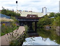
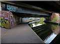
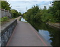
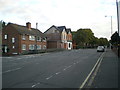
Photos of B7 5AL
Area Information
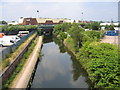
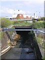
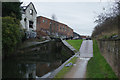
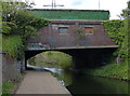
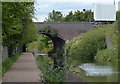
B7 5AL is a small residential cluster in Nechells, a district of central Birmingham, with a population of 1,951. This area is part of a broader urban fabric shaped by post-war redevelopment, where slum clearance in the 1950s led to the construction of low-rise housing replacing high-rises like Queens Tower, which were later demolished. Daily life here is grounded in its working-class roots, with a legacy of industries such as gasworks and railway workshops. The area is served by multiple railway stations, including Duddeston and Aston, and is within reach of retail hubs like Co-op Birmingham and Costco. Nechells’ character is defined by its mix of historic churches, such as St Clement’s, and modern amenities like Wing Yip, a Chinese food superstore. While the population is small, the area’s proximity to Birmingham city centre and its transport links make it a practical choice for those seeking a compact, connected community with a distinct industrial heritage.
- Area Type
- Postcode
- Area Size
- Not available
- Population
- 1951
- Population Density
- 2213 people/km²
The property market in B7 5AL is characterised by a 35% home ownership rate, with houses being the predominant accommodation type. This suggests a mix of owner-occupied homes and rental properties, though the exact balance between the two is not specified. The area’s housing stock reflects its post-war redevelopment, with low-rise housing replacing earlier high-rises. For buyers, this means a focus on individual homes rather than flats or apartments, which may appeal to those seeking family-friendly or long-term living spaces. The small size of the area—defined by its postcode—means the immediate surroundings are likely to include similar housing stock, with limited variation in property types. Given the historical context of slum clearance and redevelopment, properties here may benefit from recent upgrades or regeneration efforts, though specific details on property values or market trends are not available.
House Prices in B7 5AL
No properties found in this postcode.
Energy Efficiency in B7 5AL
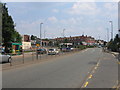
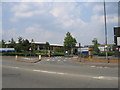
Residents of B7 5AL have access to a range of amenities within practical reach. The area is served by five railway stations, including Duddeston and Aston, and is near retail outlets like Co-op Birmingham and Costco, providing everyday shopping options. Metro stops at Bull Street and St Chads connect to Birmingham’s urban core, making public transport a viable choice for commuting. The presence of Wing Yip, a Chinese food superstore, adds to the area’s culinary diversity, while historic sites like Nechells Baths and listed churches offer cultural and recreational value. The working-class character of the area is reflected in its practical amenities, from essential retail to transport links. While the data does not specify parks or leisure facilities, the proximity to Birmingham’s city centre suggests access to larger green spaces and entertainment options. This mix of practicality and historical depth shapes a lifestyle that balances daily needs with a sense of local identity.
Amenities
Schools
Residents of B7 5AL have access to several schools, including St Clement’s Church of England Primary School and St Joseph’s Catholic Primary School, both offering primary education. The area also includes St Clement’s Church of England Academy, a secondary school with a good Ofsted rating, indicating a strong educational provision for local families. The presence of both faith-based and state-funded schools provides options for parents seeking either religious or secular education. While the data lists St Joseph’s Catholic Primary School twice, it is likely a duplicate entry. The mix of primary and academy schools suggests a focus on both early education and secondary-level academic support, though specific details on school performance or pupil outcomes are not included. Families in the area can rely on these institutions for a range of educational needs, from early years to secondary schooling.
| Rank | School | Type | Entry gender | Ages |
|---|
Explore more schools in this area
Go to Schools tabDemographics
The median age in B7 5AL is 47, with the most common age range being adults aged 30–64. Home ownership accounts for 35% of households, indicating a mix of owner-occupied and rental properties. The predominant accommodation type is houses, reflecting a residential cluster rather than high-density housing. The area’s demographic profile suggests a community with a strong presence of working-age adults, likely tied to historical industrial employment. The predominant ethnic group is Black residents, a legacy of post-war immigration from the Caribbean and Indian sub-continent. This diversity shapes the area’s cultural fabric, though specific data on deprivation or socioeconomic challenges is not provided. The age profile and home ownership rate suggest a stable, long-term resident base, though the relatively low home ownership rate may indicate a higher proportion of renters or shared housing.
Household Size
Accommodation Type
Tenure
Ethnic Group
Religion
Household Composition
Age
Household Deprivation
NS-SEC
Explore more demographic insights in this area
Go to Demographics tabPlanning
Planning Constraints
- Flood RiskPremium
- Ramsar Wetland SitesPremium
- Area of Outstanding Natural BeautyPremium
- Protected Nature ReservePremium
- Protected WoodlandPremium