Area Overview for B69 4TD
Photos of B69 4TD

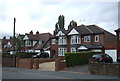
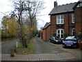
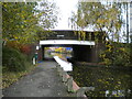
30 photos from this area
Area Information
Key information about the B69 4TD including its size, population, and administrative classification.
- Area Type
- Postcode
- Area Size
- 1.9 hectares
- Population
- 2197
- Population Density
- 5264 people/km²
House Prices in B69 4TD
51
Properties
£129,058
Average Sold Price
£20,000
Lowest Price
£250,000
Highest Price
Showing 51 properties
| Address | Type | Beds | Baths | Last Sale Price | Last Sale Date | |
|---|---|---|---|---|---|---|
| 34 Sycamore Road, Oldbury, B69 4TD | Semi-detached | 3 | 1 | £225,000 | May 2024 | |
| 44 Sycamore Road, Oldbury, B69 4TD | Semi-detached | 3 | 1 | £200,000 | Sep 2022 | |
| 43 Sycamore Road, Oldbury, B69 4TD | house | - | - | £250,000 | Jun 2022 | |
| 41 Sycamore Road, Oldbury, B69 4TD | house | - | - | £235,500 | Jun 2022 | |
| 9 Sycamore Road, Oldbury, B69 4TD | house | - | - | £200,000 | Dec 2021 | |
| 4 Sycamore Road, Oldbury, B69 4TD | house | - | - | £160,000 | Jun 2021 | |
| 13 Sycamore Road, Oldbury, B69 4TD | house | - | - | £162,000 | Mar 2021 | |
| 6 Sycamore Road, Oldbury, B69 4TD | Semi-detached | 3 | 1 | £165,000 | Sep 2019 | |
| 35 Sycamore Road, Oldbury, B69 4TD | house | 3 | 1 | £142,000 | Jul 2019 | |
| 50A Sycamore Road, Oldbury, B69 4TD | Detached | 4 | 1 | £223,000 | Jul 2017 |
Page 1 of 6
Energy Efficiency in B69 4TD
Amenities
Schools
| Rank | School | Type | Entry gender | Ages |
|---|
Explore more schools in this area
Go to Schools tabDemographics
Household Size
Family (3-5 people)
most common
Accommodation Type
Houses
most common
Tenure
70
majority
Ethnic Group
White
most common
Religion
N/A
most common
Household Composition
N/A
most common
Age
47
median
Adults (30-64 years)
most common
Household Deprivation
N/A
with no deprivation
NS-SEC
23
in Lower managerial occupations
Explore more demographic insights in this area
Go to Demographics tabPlanning
Planning Constraints
- Flood RiskPremium
- Ramsar Wetland SitesPremium
- Area of Outstanding Natural BeautyPremium
- Protected Nature ReservePremium
- Protected WoodlandPremium