Area Overview for B69 4SX
Photos of B69 4SX

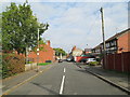
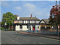
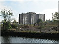
90 photos from this area
Area Information
Key information about the B69 4SX including its size, population, and administrative classification.
- Area Type
- Postcode
- Area Size
- 3548 m²
- Population
- 1529
- Population Density
- 3539 people/km²
House Prices in B69 4SX
20
Properties
£94,143
Average Sold Price
£34,000
Lowest Price
£135,000
Highest Price
Showing 20 properties
| Address | Type | Beds | Baths | Last Sale Price | Last Sale Date | |
|---|---|---|---|---|---|---|
| 70 Arden Grove, Oldbury, B69 4SX | Semi-detached | 2 | 1 | £129,000 | Jan 2024 | |
| 42 Arden Grove, Oldbury, B69 4SX | Terraced | - | - | £110,000 | Oct 2020 | |
| 40 Arden Grove, Oldbury, B69 4SX | Terraced | 2 | 1 | £108,000 | Mar 2020 | |
| 28 Arden Grove, Oldbury, B69 4SX | house | 2 | 1 | £77,000 | Apr 2019 | |
| 20 Arden Grove, Oldbury, B69 4SX | Terraced | 3 | 2 | £122,000 | Nov 2018 | |
| 26 Arden Grove, Oldbury, B69 4SX | house | - | - | £90,000 | Jan 2016 | |
| 24 Arden Grove, Oldbury, B69 4SX | Terraced | 2 | 1 | £80,000 | Jan 2016 | |
| 38 Arden Grove, Oldbury, B69 4SX | house | - | - | £83,500 | Sep 2014 | |
| 72 Arden Grove, Oldbury, B69 4SX | Semi-detached | 2 | - | £116,000 | Feb 2014 | |
| 30 Arden Grove, Oldbury, B69 4SX | house | 2 | 1 | £94,000 | Jun 2011 |
Page 1 of 2
Energy Efficiency in B69 4SX
Amenities
Schools
| Rank | School | Type | Entry gender | Ages |
|---|
Explore more schools in this area
Go to Schools tabDemographics
Household Size
One person
most common
Accommodation Type
Houses
most common
Tenure
36
majority
Ethnic Group
White
most common
Religion
N/A
most common
Household Composition
N/A
most common
Age
47
median
Adults (30-64 years)
most common
Household Deprivation
N/A
with no deprivation
NS-SEC
18
in Lower managerial occupations
Explore more demographic insights in this area
Go to Demographics tabPlanning
Planning Constraints
- Flood RiskPremium
- Ramsar Wetland SitesPremium
- Area of Outstanding Natural BeautyPremium
- Protected Nature ReservePremium
- Protected WoodlandPremium