Area Overview for B69 4QS
Photos of B69 4QS
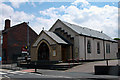
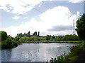
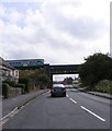
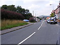
47 photos from this area
Area Information
Key information about the B69 4QS including its size, population, and administrative classification.
- Area Type
- Postcode
- Area Size
- 1.8 hectares
- Population
- 2197
- Population Density
- 5264 people/km²
House Prices in B69 4QS
52
Properties
£134,363
Average Sold Price
£45,000
Lowest Price
£345,000
Highest Price
Showing 52 properties
| Address | Type | Beds | Baths | Last Sale Price | Last Sale Date | |
|---|---|---|---|---|---|---|
| 140 Pool Lane, Oldbury, B69 4QS | Semi-detached | 5 | 1 | £345,000 | Jul 2023 | |
| 178 Pool Lane, Oldbury, B69 4QS | house | 3 | - | £120,000 | Jun 2022 | |
| 95 Pool Lane, Oldbury, B69 4QS | house | 3 | - | £216,000 | Jun 2021 | |
| 139 Pool Lane, Oldbury, B69 4QS | Semi-detached | 3 | 1 | £157,000 | Mar 2020 | |
| 100 Pool Lane, Oldbury, B69 4QS | Semi-detached | 6 | 1 | £87,500 | Oct 2019 | |
| 146 Pool Lane, Oldbury, B69 4QS | Semi-detached | 3 | 1 | £152,500 | Jan 2018 | |
| Pool Cottage, 121 Pool Lane, Oldbury, B69 4QS | Bungalow | 2 | 1 | £146,000 | Jan 2017 | |
| 149 Pool Lane, Oldbury, B69 4QS | house | - | - | £147,950 | May 2016 | |
| 116 Pool Lane, Oldbury, B69 4QS | Terraced | 3 | - | £123,000 | Apr 2016 | |
| 151 Pool Lane, Oldbury, B69 4QS | house | - | - | £148,000 | Aug 2015 |
Page 1 of 6
Energy Efficiency in B69 4QS
Amenities
Schools
| Rank | School | Type | Entry gender | Ages |
|---|
Explore more schools in this area
Go to Schools tabDemographics
Household Size
Family (3-5 people)
most common
Accommodation Type
Houses
most common
Tenure
70
majority
Ethnic Group
White
most common
Religion
N/A
most common
Household Composition
N/A
most common
Age
47
median
Adults (30-64 years)
most common
Household Deprivation
N/A
with no deprivation
NS-SEC
23
in Lower managerial occupations
Explore more demographic insights in this area
Go to Demographics tabPlanning
Planning Constraints
- Flood RiskPremium
- Ramsar Wetland SitesPremium
- Area of Outstanding Natural BeautyPremium
- Protected Nature ReservePremium
- Protected WoodlandPremium