Area Overview for B69 4LX
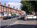
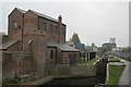
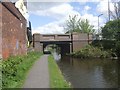
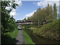
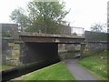
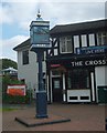
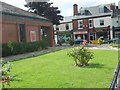
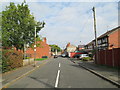
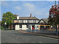
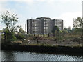
Photos of B69 4LX


Area Information
B69 4LX represents a small residential cluster with a population of 1,976 people, defined by its specific postcode within the broader Oldbury region. This location sits at a population density of 1,447 people per square kilometre, creating a tightly knit environment where neighbours are often within reaching distance. The area encompasses a mix of housing currently occupied by a community with distinct historical roots, as Oldbury has evolved from an industrial hub since the late 18th century into the modern administrative centre of the West Midlands. Residents here benefit from a compact footprint that places significant infrastructure nearby, including transport links and local shops. The geography includes features like Albright Recreation Ground, which offers sports pitches and an ornamental pool, providing accessible open space for recreation. Daily life in B69 4LX revolves around practical connectivity and proximity to key services. The area was part of the Manor of Halesowen historically but merged into Warley in 1966 and Sandwell in 1974, shaping its current administrative and social landscape. You will find yourself surrounded by amenities that include Langley Green Railway Station and major retail outlets such as Asda Oldbury. Despite being a specific postcode rather than a named village, the cluster functions as a cohesive neighbourhood with 1,447 inhabitants living in close quarters. This density ensures that services are not merely accessible but integrated into your immediate surroundings. Families and professionals alike share this space, creating a community focused on convenience and local history. The presence of landmarks like Christchurch, opened in 1841, adds a layer of heritage that residents encounter every day while navigating their streets.
- Area Type
- Postcode
- Area Size
- Not available
- Population
- 1976
- Population Density
- 1447 people/km²
Homes in B69 4LX consist predominantly of houses, distinguishing this postcode from areas saturated with apartment blocks. This housing stock provides a traditional suburban feel with private gardens and separate entrances, appealing to those seeking space within the dense urban fabric of the West Midlands. The market landscape is defined by a home ownership rate of 30 per cent, indicating that the majority of properties are let rather than owned outright. For buyers looking at this small cluster, this statistic suggests a competitive rental market with a strong turnover of occupants. The exclusive focus on houses means you will find detached or semi-detached properties rather than low-rise flats or high-density developments common in nearby conurbations. This majority rental environment reflects the transitional nature of the area as part of the larger Oldbury and Sandwell municipality. Residents move frequently, driven by job opportunities in adjacent industrial zones or family circumstances, keeping the local housing stock fluid. The population of 1,976 indicates a limited supply of individual homes, which can intensify competition for properties that do become available. Homeowners in B69 4LX hold a minority stake compared to the wider stock, suggesting that builders and investors may dominate the supply side. Buyers interested in purchasing a house here face a market where ownership is less common than tenancy. The accommodation type remains consistent across the postcode, ensuring uniformity in building style and zoning. Families relocating to this cluster should expect to navigate a market where securing a fixed-term lease or purchasing requires navigating a tenant-heavy ecosystem.
House Prices in B69 4LX
No properties found in this postcode.
Energy Efficiency in B69 4LX
Living in B69 4LX offers convenient access to a wide variety of amenities within practical reach of residents. The cluster is well-served by retail options including Asda Oldbury, Aldi Langley, and Farmfoods Oldbury, ensuring daily shopping needs are met without lengthy journeys. Five railway stations, including Sandwell & Dudley and Langley Green, provide quick links to the wider region, integrating the postcode into the daily rhythm of the West Midlands. For leisure, Kenrick Park and Trinity Way offer local stops for travel or short trips, while West Bromwich Central serves as a larger metropolitan hub nearby. These transport nodes and retail outlets create a lifestyle where essentials are immediate and longer distances are manageable. The historical character of Oldbury adds depth to the local experience. Landmarks like Albright Recreation Ground, opened in 1886, feature flowerbeds and sports pitches that encourage outdoor activity. Nearby venues include Trinity Way and Kenrick Park, which serve as community focal points. The presence of food retailers like Farmfoods and Aldi supports a practical approach to daily life, catering to busy schedules. Residents can walk to or easily drive to these facilities, reducing the need for extensive travel. The lifestyle here balances the convenience of modern high-street shopping with the quiet of a residential cluster. With five local retail outlets and five railway stations within reach, the area functions as a self-contained node within the larger urban sprawl. History enthusiasts can explore the local past through sites like the Old Courthouse, while parents enjoy parks and schools nearby.
Amenities
Schools
Families living in B69 4LX have access to several primary education options within practical reach, catering to the community's young residents. Christ Church CofE Primary School offers education at the primary level with an Ofsted rating of satisfactory, providing a faith-based curriculum for local children. St Francis Xavier Catholic Primary School also serves the area, and notably, one rating for this institution is listed as good, indicating higher educational standards at this specific location. These schools represent the main entry points for education before pupils move to secondary institutions elsewhere in the borough. The presence of two primary options with different religious backgrounds gives families choice in their educational philosophy. The mix of school types includes Catholic institutions and Church of England schools, reflecting the diverse denominational affiliations within the local population. With the median age of residents at 47, there is a significant cohort of parents likely choosing between these primary schools or commuting for secondary education. Ofsted ratings provide crucial insight into performance, with the 'good' rating for St Francis Xavier Catholic Primary School setting a positive benchmark for prospective families. Christ Church CofE Primary School's satisfactory rating suggests a developing institution that meets baseline expectations. These schools are located near the residential cluster, ensuring that students in B69 4LX do not face long commutes for their early education. The availability of multiple primary options supports a community where raising children is a central planning factor for many households relocating to the area.
| Rank | School | Type | Entry gender | Ages |
|---|
Explore more schools in this area
Go to Schools tabDemographics
The community profile of B69 4LX is characterised by a median age of 47 years, with adults between 30 and 64 forming the most common age range. This demographic skew indicates an area populated by established families and working professionals rather than students or retirees. Household composition reflects this maturity, as defined by a population where over a third of residents have reached middle adulthood. You will find that 30 per cent of local homes are owner-occupied, meaning a majority of the housing stock is rented. This rental-heavy landscape suggests a dynamic turnover of tenants and landlords, typical of urbanising clusters within the Sandwell borough. Diversity in B69 4LX is distinctly shaped by its ethnic composition, where the predominant group is White. The population density of 1,447 people per square kilometre creates a vibrant setting where higher population numbers concentrate within a relatively small geographic area. Housing types are exclusively houses for this postcode, differentiating it from flatter urban cores dominated by apartments. The age profile offers stability; with the majority of residents falling between 30 and 64 years old, the neighbourhood avoids the extreme youthfulness or senescence often found in other parts of the West Midlands. Children, who primarily inhabit the 30 and under bracket, likely attend local schools nearby, while the 65 and over group represents the smaller senior demographic. This middle-aged core implies that local businesses and amenities cater to parents and workers who require reliable transport and practical services. The balance of renters and owners creates a layered society where long-term stability mixes with mobile living arrangements.
Household Size
Accommodation Type
Tenure
Ethnic Group
Religion
Household Composition
Age
Household Deprivation
NS-SEC
Explore more demographic insights in this area
Go to Demographics tabPlanning
Planning Constraints
- Flood RiskPremium
- Ramsar Wetland SitesPremium
- Area of Outstanding Natural BeautyPremium
- Protected Nature ReservePremium
- Protected WoodlandPremium