Area Overview for B69 4EW
Photos of B69 4EW

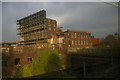
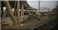
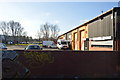
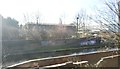

100 photos from this area
Area Information
Key information about the B69 4EW including its size, population, and administrative classification.
- Area Type
- Postcode
- Area Size
- 7216 m²
- Population
- 1999
- Population Density
- 2467 people/km²
House Prices in B69 4EW
34
Properties
£106,582
Average Sold Price
£65,000
Lowest Price
£230,000
Highest Price
Showing 34 properties
| Address | Type | Beds | Baths | Last Sale Price | Last Sale Date | |
|---|---|---|---|---|---|---|
| 213 Birmingham Road, Oldbury, B69 4EW | Flat | - | - | £84,500 | Aug 2025 | |
| 183 Birmingham Road, Oldbury, B69 4EW | Semi-detached | 3 | 2 | £230,000 | Jun 2023 | |
| 211 Birmingham Road, Oldbury, B69 4EW | Flat | 2 | 1 | £103,000 | Apr 2022 | |
| 199 Birmingham Road, Oldbury, B69 4EW | Flat | - | - | £97,000 | Dec 2021 | |
| 203 Birmingham Road, Oldbury, B69 4EW | Flat | - | - | £80,000 | Sep 2021 | |
| 189 Birmingham Road, Oldbury, B69 4EW | Detached | 4 | 3 | £170,000 | Oct 2020 | |
| 207 Birmingham Road, Oldbury, B69 4EW | Flat | 2 | 1 | £93,000 | Jun 2020 | |
| 175 Birmingham Road, Oldbury, B69 4EW | Terraced | 3 | 1 | £185,000 | Sep 2019 | |
| 157 Birmingham Road, Oldbury, B69 4EW | Flat | - | - | £100,000 | Aug 2019 | |
| 201 Birmingham Road, Oldbury, B69 4EW | Flat | - | - | £70,000 | Mar 2018 |
Page 1 of 4
Energy Efficiency in B69 4EW
Amenities
Schools
| Rank | School | Type | Entry gender | Ages |
|---|
Explore more schools in this area
Go to Schools tabDemographics
Household Size
Family (3-5 people)
most common
Accommodation Type
Houses
most common
Tenure
51
majority
Ethnic Group
asian_total
most common
Religion
N/A
most common
Household Composition
N/A
most common
Age
47
median
Adults (30-64 years)
most common
Household Deprivation
N/A
with no deprivation
NS-SEC
13
in Lower managerial occupations
Explore more demographic insights in this area
Go to Demographics tabPlanning
Planning Constraints
- Flood RiskPremium
- Ramsar Wetland SitesPremium
- Area of Outstanding Natural BeautyPremium
- Protected Nature ReservePremium
- Protected WoodlandPremium