Area Overview for B69 4EL
Photos of B69 4EL
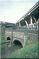


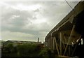
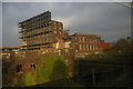
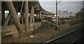

100 photos from this area
Area Information
Key information about the B69 4EL including its size, population, and administrative classification.
- Area Type
- Postcode
- Area Size
- 1.5 hectares
- Population
- 1999
- Population Density
- 2467 people/km²
House Prices in B69 4EL
45
Properties
£96,532
Average Sold Price
£31,500
Lowest Price
£250,000
Highest Price
Showing 45 properties
| Address | Type | Beds | Baths | Last Sale Price | Last Sale Date | |
|---|---|---|---|---|---|---|
| 47 Fisher Road, Oldbury, B69 4EL | Terraced | 3 | 1 | £161,000 | Apr 2025 | |
| 27 Fisher Road, Oldbury, B69 4EL | Terraced | 3 | 1 | £185,000 | Jan 2024 | |
| 56 Fisher Road, Oldbury, B69 4EL | house | - | - | £230,000 | Feb 2023 | |
| 50 Fisher Road, Oldbury, B69 4EL | house | - | - | £250,000 | Nov 2022 | |
| 12 Fisher Road, Oldbury, B69 4EL | house | - | - | £132,000 | Apr 2021 | |
| 26 Fisher Road, Oldbury, B69 4EL | house | - | - | £150,000 | Mar 2021 | |
| 39 Fisher Road, Oldbury, B69 4EL | Terraced | 3 | 1 | £121,000 | Nov 2020 | |
| 10 Fisher Road, Oldbury, B69 4EL | Terraced | 3 | 1 | £105,000 | Jun 2019 | |
| 3 Fisher Road, Oldbury, B69 4EL | Terraced | 3 | 1 | £93,000 | May 2018 | |
| 24 Fisher Road, Oldbury, B69 4EL | Terraced | 3 | 1 | £117,500 | Apr 2018 |
Page 1 of 5
Energy Efficiency in B69 4EL
Amenities
Schools
| Rank | School | Type | Entry gender | Ages |
|---|
Explore more schools in this area
Go to Schools tabDemographics
Household Size
Family (3-5 people)
most common
Accommodation Type
Houses
most common
Tenure
51
majority
Ethnic Group
asian_total
most common
Religion
N/A
most common
Household Composition
N/A
most common
Age
47
median
Adults (30-64 years)
most common
Household Deprivation
N/A
with no deprivation
NS-SEC
13
in Lower managerial occupations
Explore more demographic insights in this area
Go to Demographics tabPlanning
Planning Constraints
- Flood RiskPremium
- Ramsar Wetland SitesPremium
- Area of Outstanding Natural BeautyPremium
- Protected Nature ReservePremium
- Protected WoodlandPremium