Area Overview for B69 4AF
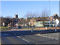
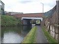
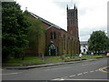
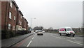
Photos of B69 4AF


Area Information
B69 4AF is a specific postcode covering a small residential cluster within the broader market town of Oldbury, situated in the Sandwell metropolitan borough. Oldbury historically functioned as an administrative centre, having evolved from a separate manor following the Dissolution of the Monasteries to serve as an Urban District from 1894. This specific area hosts a population of 1,976 residents, creating a tightly knit community defined by its proximity to local infrastructure. The neighbourhood sits near the coordinates 52.503992, -2.009061, aligning it with the historical heart of Oldbury which encompasses areas like Langley and Warley. Residents here navigate a landscape rich with industrial heritage, including historic ironworks and coal mining sites that shaped the local economy from the late 18th century. Daily life in this cluster involves close proximity to key landmarks such as Christchurch, opened in 1841, and the Albright Recreation Ground, established in 1886. The area offers a specific blend of residential living within 14,470 square kilometres of surrounding land, though the population density of 1,447 people per square kilometre indicates a more concentrated living environment compared to wider rural stretches. You will find yourself surrounded by structures that reflect the borough's administrative significance, from the Old Courhouse to the Council Offices. Living in B69 4AF means engaging with a place where the boundary between past industrial ambition and present-day residential needs is clearly visible in the architecture and street layout.
- Area Type
- Postcode
- Area Size
- Not available
- Population
- 1976
- Population Density
- 1447 people/km²
The property market in B69 4AF is characterised by a distinct imbalance between ownership and rental, with only 30 per cent of homes privately owned. This statistic implies that over 70 per cent of the housing stock consists of rented accommodation. The accommodation type data confirms that houses predominate in this postal cluster, meaning you will primarily find detached or semi-detached structures rather than blocks of flats or apartments. This housing mix is typical of residential clusters on the edges of established urban areas like Oldbury. For buyers looking at homes in B69 4AF, the high rental rate signals that the area may attract investors or professionals on temporary contracts. However, the prevalence of houses suggests a certain level of character and space that is less common in urban centres. If you are considering purchasing, the 30 per cent ownership rate indicates you are entering a market where competition for purchase-ready properties might vary depending on landlord turnover. The specific nature of this small residential cluster means that property values are influenced heavily by the immediate surroundings and the desirability of the house types prevalent in Oldbury. Understanding that this is a rental-led market helps frame your expectations regarding local investment dynamics and potential price fluctuations.
House Prices in B69 4AF
No properties found in this postcode.
Energy Efficiency in B69 4AF
Residents of B69 4AF enjoy convenient access to essential amenities within practical reach of their homes. Five retail locations operate nearby, including Sainsburys Oldbury, Iceland Oldbury, and Farmfoods West, ensuring daily shopping needs are met without extensive travel. For commuters, transport links are comprehensive, with five rail stations listed in the vicinity: Sandwell & Dudley Railway Station, Langley Green Railway Station, and Smethwick Galton Bridge High Level Railway Station stand out as key hubs. Public transport options further expand mobility, featuring five metro stops such as West Bromwich Central, Trinity Way, and Lodge Road. These transit points connect the residential cluster to wider economic centres across the West Midlands. Living in B69 4AF means you are close to significant transport arteries that serviciye everyday commutes to jobs in Dudley or Birmingham. The proximity to Sainsburys and Iceland allows for quick supermarket runs, while the network of rail and metro stations provides escape routes to larger cities or destinations for leisure. This blend of high street retail and major transport nodes creates a lifestyle where essential services are never far away. You do not need to travel deep into the city centre for basic needs, yet you retain access to broader regional opportunities.
Amenities
Schools
Families considering schools near B69 4AF have access to two primary options with confirmed inspection ratings. Christ Church CofE Primary School holds an Ofsted rating of satisfactory, offering faith-based education within the local catchment. Additionally, St Francis Xavier Catholic Primary School is rated as good by Ofsted, providing a Roman Catholic education option with higher inspection standards. While another entry for St Francis Xavier exists in the local database, the good rating at this institution stands out as a positive factor for parents seeking formal educational quality. The mix of Church of England and Catholic primary schools reflects the historical religious diversity present in Oldbury since the 19th century. This selection allows parents to choose between a satisfactory and a good-rated institution, with St Francis Xavier being the stronger performer according to recent assessments. Living in B69 4AF means your children will likely attend one of these local primary schools, shaping their early education in a traditionally strong educational zone. The availability of these specific faith schools indicates a community with established religious traditions. You should verify catchment boundaries as they do not always align perfectly with postcode lines, but these two named schools are the confirmed local options.
| Rank | School | Type | Entry gender | Ages |
|---|
Explore more schools in this area
Go to Schools tabDemographics
The community in B69 4AF is defined by a mature demographic structure, with a median age of 47 years. The most common age range consists of adults aged between 30 and 64 years, suggesting a neighbourhood dominated by established families and career professionals rather than young singles or pensioners. Home ownership stands at 30 per cent, indicating that a significant majority of residents rent their properties. This high rental proportion often points to a transient or investment-driven market rather than a solely owner-occupied settlement. The predominant ethnic group is White, which aligns with the broader demographic trends observed in the Black Country region. Accommodation types in this postcode area centre primarily on houses, reinforcing the character of a residential cluster rather than a high-rise or flat-heavy district. While specific data on income deprivation is not included in the available profile, the presence of a 30 per cent home ownership rate and the specific age profile suggest a community with varied economic standing. Residents here likely possess stable employment, given the concentration of working-age adults. The housing stock consists largely of houses, providing space for the adult population prevalent in the area. Living in B69 4AF involves joining a community where the majority are long-term tenants, meaning neighbours may change more frequently than in areas with higher ownership rates.
Household Size
Accommodation Type
Tenure
Ethnic Group
Religion
Household Composition
Age
Household Deprivation
NS-SEC
Explore more demographic insights in this area
Go to Demographics tabPlanning
Planning Constraints
- Flood RiskPremium
- Ramsar Wetland SitesPremium
- Area of Outstanding Natural BeautyPremium
- Protected Nature ReservePremium
- Protected WoodlandPremium