Area Overview for B69 4AE
Photos of B69 4AE

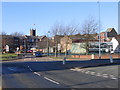
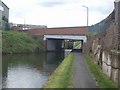
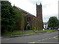
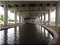


100 photos from this area
Area Information
Key information about the B69 4AE including its size, population, and administrative classification.
- Area Type
- Postcode
- Area Size
- 2.3 hectares
- Population
- 1976
- Population Density
- 1447 people/km²
House Prices in B69 4AE
27
Properties
£74,496
Average Sold Price
£19,750
Lowest Price
£98,950
Highest Price
Showing 27 properties
| Address | Type | Beds | Baths | Last Sale Price | Last Sale Date | |
|---|---|---|---|---|---|---|
| 42 Flash Road, Oldbury, B69 4AE | Flat | - | - | £86,000 | Mar 2021 | |
| 32 Flash Road, Oldbury, B69 4AE | Flat | - | - | £98,000 | Jun 2008 | |
| 34 Flash Road, Oldbury, B69 4AE | Flat | - | - | £98,950 | Dec 2005 | |
| 36 Flash Road, Oldbury, B69 4AE | Flat | - | - | £79,275 | Nov 2005 | |
| 10 Flash Road, Oldbury, B69 4AE | Terraced | 3 | 1 | £65,000 | Aug 2003 | |
| 18 Flash Road, Oldbury, B69 4AE | Terraced | - | - | £19,750 | Oct 1998 | |
| 40 Flash Road, Oldbury, B69 4AE | Flat | 2 | 1 | - | - | |
| 54 Flash Road, Oldbury, B69 4AE | Flat | 3 | 3 | - | - | |
| Brook Hall Management Service, Chanton House, Flash Road, Oldbury, B69 4AE | Office | - | - | - | - | |
| 50 Flash Road, Oldbury, B69 4AE | Flat | - | - | - | - |
Page 1 of 3
Energy Efficiency in B69 4AE
Amenities
Schools
| Rank | School | Type | Entry gender | Ages |
|---|
Explore more schools in this area
Go to Schools tabDemographics
Household Size
One person
most common
Accommodation Type
Houses
most common
Tenure
30
majority
Ethnic Group
White
most common
Religion
N/A
most common
Household Composition
N/A
most common
Age
47
median
Adults (30-64 years)
most common
Household Deprivation
N/A
with no deprivation
NS-SEC
17
in Lower managerial occupations
Explore more demographic insights in this area
Go to Demographics tabPlanning
Planning Constraints
- Flood RiskPremium
- Ramsar Wetland SitesPremium
- Area of Outstanding Natural BeautyPremium
- Protected Nature ReservePremium
- Protected WoodlandPremium