Area Overview for B69 3BB
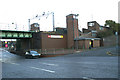
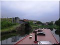
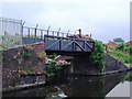
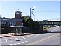
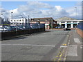
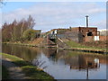
Photos of B69 3BB


Area Information
Living in B69 3BB means inhabiting a compact, densely populated residential cluster in England’s West Midlands. With a population of 1,976 and a density of 1,447 people per square kilometre, this area reflects a tight-knit community shaped by historical industrial roots. The postcode falls within Oldbury, a town with a legacy of ironworks and canals, now redefined by modern infrastructure. Daily life here is anchored by proximity to rail networks, retail hubs, and educational institutions. The area’s compact size means amenities are within practical reach, though its small footprint also means limited expansion. Residents benefit from a mix of traditional and contemporary services, with schools like Christ Church CofE Primary and St Francis Xavier Catholic Primary serving local families. While the area’s industrial past is evident in its architecture, its present offers a blend of practical living and accessible connectivity. For those seeking a place where community and convenience intersect, B69 3BB provides a distinct, if tightly packed, urban experience.
- Area Type
- Postcode
- Area Size
- Not available
- Population
- 1976
- Population Density
- 1447 people/km²
The property market in B69 3BB is characterised by a 30% home ownership rate, suggesting a rental-dominated landscape. The accommodation type is primarily houses, which, combined with the area’s high population density, indicates a mix of family homes and multi-occupancy properties. This dynamic may reflect a demand for larger living spaces in a compact area, though the limited number of homes could mean competition for available properties. For buyers, the small size of the postcode area means the market is likely to be influenced by nearby zones such as Oldbury and Langley. The predominance of houses may appeal to families seeking space, but the rental market’s strength could mean limited opportunities for owner-occupiers. Prospective buyers should consider the area’s constraints, as its small footprint may limit future development or investment potential.
House Prices in B69 3BB
No properties found in this postcode.
Energy Efficiency in B69 3BB
Daily life in B69 3BB is shaped by its proximity to retail, leisure, and transport hubs. The area’s five retail outlets, including Sainsburys Oldbury and Spar, provide essential shopping and convenience services. Nearby rail and metro stations, such as Sandwell & Dudley and West Bromwich Central, connect residents to broader networks, facilitating both local and regional travel. Recreational spaces are less explicitly detailed, but the area’s historical roots suggest potential green spaces or parks. The presence of multiple schools and community institutions indicates a focus on family-oriented amenities. While the data does not specify dining or leisure venues, the compact layout ensures that essential services are within walking or short driving distance, contributing to a practical, accessible lifestyle.
Amenities
Schools
Near B69 3BB are three primary schools, each serving the local community. Christ Church CofE Primary School holds an Ofsted rating of satisfactory, while St Francis Xavier Catholic Primary School is rated good. Both schools cater to younger children, offering a range of educational options for families. The presence of two Catholic schools, including one with a strong rating, may appeal to parents seeking faith-based education. The mix of church-affiliated and state schools provides flexibility, though the data does not specify secondary education options. For families prioritising school quality, the good-rated St Francis Xavier school is a notable asset. However, the limited number of schools suggests a focus on primary education, with potential reliance on nearby institutions for secondary needs.
| Rank | A + A* % | School | Type | Entry gender | Ages |
|---|---|---|---|---|---|
| 1 | N/A | Christ Church CofE Primary School | primary | N/A | N/A |
| 2 | N/A | St Francis Xavier Catholic Primary School | primary | N/A | N/A |
| 3 | N/A | St Francis Xavier Catholic Primary School | primary | N/A | N/A |
Explore more schools in this area
Go to Schools tabDemographics
The community in B69 3BB is predominantly composed of adults aged 30–64, with a median age of 47. This suggests a mature, stable population, likely with established careers and families. Home ownership rates stand at 30%, indicating a majority of residents are renters, which may reflect the area’s character as a rental-focused zone. The accommodation type is primarily houses, though the high population density implies these are often multi-generational or shared dwellings. The predominant ethnic group is White, with no specific data on other demographics. The age profile and ownership figures suggest a community centred on middle-aged individuals, possibly with children in local schools. While the data does not specify deprivation levels, the 30% ownership rate may correlate with higher rental costs or a focus on long-term tenancy. This demographic mix shapes a neighbourhood where stability and practical living are prioritised.
Household Size
Accommodation Type
Tenure
Ethnic Group
Religion
Household Composition
Age
Household Deprivation
NS-SEC
Explore more demographic insights in this area
Go to Demographics tabPlanning
Planning Constraints
- Flood RiskLocked
- Ramsar Wetland SitesLocked
- Area of Outstanding Natural BeautyLocked
- Protected Nature ReserveLocked
- Protected WoodlandLocked
- Crime RiskLocked