Area Overview for B69 3BA
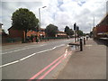
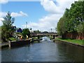
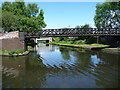
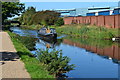
Photos of B69 3BA


Area Information
Living in B69 3BA means being part of a small, densely populated residential cluster in the West Midlands. The area’s 2,441 residents, spread across 1.5 km², create a compact community with a median age of 47, dominated by adults aged 30–64. This suggests a mature, stable population, with 56% owning their homes and the majority living in houses rather than flats. The postcode sits within Oldbury, a historic market town that once thrived on ironworks and coal mining. Today, its character blends industrial heritage with modern living, though the area’s small size means proximity to nearby towns like Sandwell and Dudley is key. Residents benefit from nearby schools, rail links, and retail, while the high population density reflects a focus on established housing rather than expansion. For those seeking a quiet, family-oriented environment with access to urban amenities, B69 3BA offers a balance of tradition and practicality.
- Area Type
- Postcode
- Area Size
- Not available
- Population
- 2441
- Population Density
- 1643 people/km²
The property market in B69 3BA is characterised by a 56% home ownership rate, with houses forming the predominant accommodation type. This suggests a focus on owner-occupied, family homes rather than a rental-heavy market. Given the area’s small size and high population density, the housing stock is likely limited, with little scope for new builds. Buyers should consider the proximity to nearby towns like Sandwell and Dudley, where additional options may exist. The predominance of houses indicates a demand for larger properties, possibly appealing to families. However, the lack of specific data on property prices or availability means buyers must look beyond the immediate postcode for a broader range of options. The compact nature of the area also means competition for homes could be fierce, especially for those prioritising space or specific amenities.
House Prices in B69 3BA
No properties found in this postcode.
Energy Efficiency in B69 3BA
The lifestyle in B69 3BA is shaped by its proximity to essential amenities, including five rail stations, five retail outlets, and five metro stops. Sainsburys Oldbury and Iceland Oldbury provide convenient shopping, while Spar offers smaller convenience options. The metro stops, such as Dudley Street Guns Village, suggest a network of local transport links that support both daily errands and broader travel. While the data does not specify parks or leisure facilities, the area’s historical roots in industrial activity may hint at a blend of urban and practical living. The compact nature of the postcode means amenities are closely grouped, reducing travel times for residents. However, the absence of named parks or recreational spaces in the data implies that outdoor activities may require venturing to nearby towns. Overall, the area caters to practical, everyday needs with a focus on accessibility.
Amenities
Schools
Residents of B69 3BA have access to multiple primary schools, including Rounds Green Primary School, Rounds Green Junior School, Rounds Green Infant School, and a second listing of Rounds Green Primary School with a ‘good’ Ofsted rating. This concentration of primary schools suggests a strong local education infrastructure, with options for different age groups. The presence of three distinct schools, including one with a formal rating, indicates a focus on early education, which is crucial for families with young children. However, the data does not specify secondary schools or higher education options, meaning parents may need to look further afield for comprehensive schooling. The mix of schools likely provides flexibility, though the absence of diversity in school types (all primary) means secondary education planning must consider nearby areas.
| Rank | School | Type | Entry gender | Ages |
|---|
Explore more schools in this area
Go to Schools tabDemographics
The community in B69 3BA is predominantly composed of adults aged 30–64, with a median age of 47, indicating a mature population. Home ownership stands at 56%, suggesting a mix of owner-occupied properties and rental stock, though the exact proportion of rentals is not specified. The area’s accommodation is primarily houses, reflecting a preference for single-family homes over flats. The predominant ethnic group is White, though specific data on diversity or deprivation is absent. The high population density of 1,643 people per km², combined with the small area’s size, implies a tightly knit community where social networks may be strong. However, the lack of detailed demographic breakdowns on income or deprivation means broader quality-of-life implications remain unquantified. For buyers, this suggests a stable, established area with limited scope for new development.
Household Size
Accommodation Type
Tenure
Ethnic Group
Religion
Household Composition
Age
Household Deprivation
NS-SEC
Explore more demographic insights in this area
Go to Demographics tabPlanning
Planning Constraints
- Flood RiskPremium
- Ramsar Wetland SitesPremium
- Area of Outstanding Natural BeautyPremium
- Protected Nature ReservePremium
- Protected WoodlandPremium